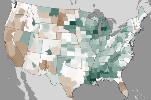
Winter storms in February improved drought in the Southeast and Midwest, but well below average precipitation in parts of the West in recent months has worsened drought in other places.
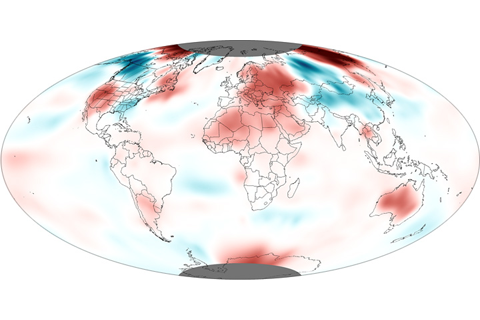
January 2013 was the 37th consecutive January and 335th consecutive month with a global temperature above the 20th-century average. The last below-average January was in 1976.
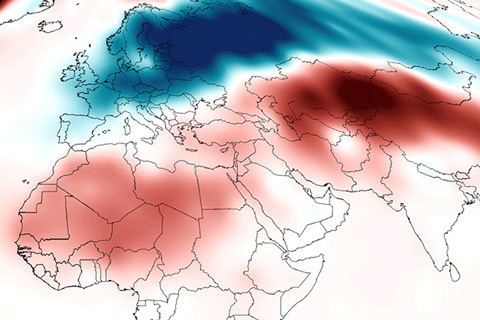
Despite several snowstorms associated with cold-air outbreaks, average January temperatures across the contiguous United States weren’t especially cold according to the latest statistics from NOAA’s National Climatic Data Center. Although the average temperature was spot-on freezing—32.0° Fahrenheit—that was still 1.6° Fahrenheit warmer than the twentieth-century January average.
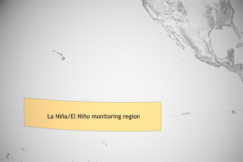
As the whole ocean gets warmer, NOAA scientists must redefine what they consider “average” temperature in the central tropical Pacific, where they keep watch for El Niño and La Niña.
Although 2012 warmth did not top the charts, it was the third warmest “La Niña year” on record.
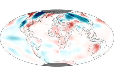
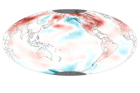
The average global temperature for November 2012 was the fifth warmest November since record keeping began in 1880.
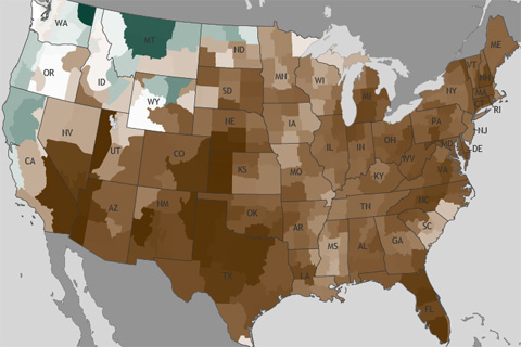
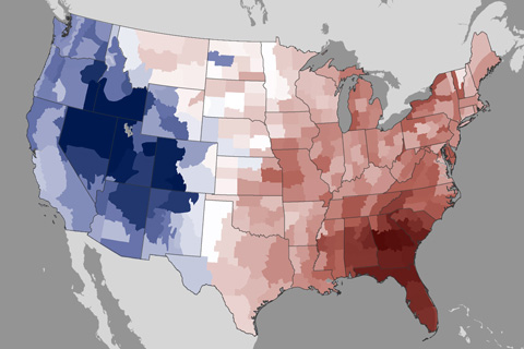
The November nationally averaged precipitation total of 1.19 inches was nearly an inch below the long-term average, making this the eighth driest November on record.
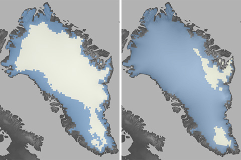
The summer of 2012 brought Greenland far more extensive melt than anything observed in the satellite record: in July 2012, surface melt extended over nearly the entire ice sheet. The standardized melt index was nearly double the previous record.
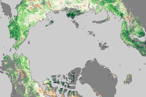
Few real-world signs of climate change are easier to read than changes in the growing season of familiar vegetation. Most of the high-latitudes of the Northern Hemisphere are experiencing longer growing seasons now than they did more than two and half decades ago.