The fingerprints of La Niña were all over the global precipitation map.
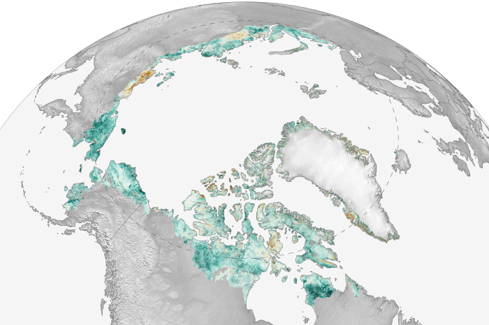
But fires and other disturbances create patches of "browning" in satellites' view of Arctic vegetation.
A record-warm autumn boosted Arctic 2020-21 surface temperatures to the rank of seventh-warmest year on record since 1900.
Climate change is transforming the Arctic into a ‘dramatically different state.’ Browse this collection of image highlights from NOAA's 2021 Arctic Report Card.
Dry conditions were unusually widespread, and total drought area increased by more than 5 percent.

In a tweet chat featuring four NOAA marine experts, learn about the National Marine Ecosystem Status website, how to use it, and why you should care about the health of marine ecosystems.
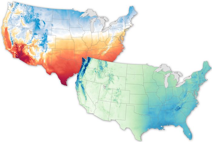
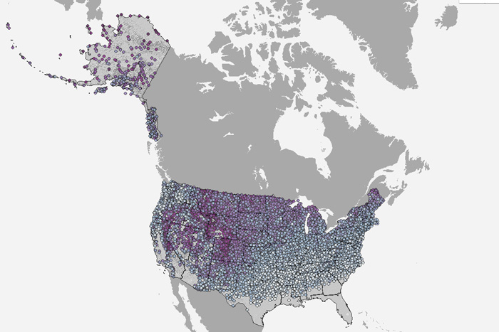
Maps showcase the broad range of climates across the contiguous United States.
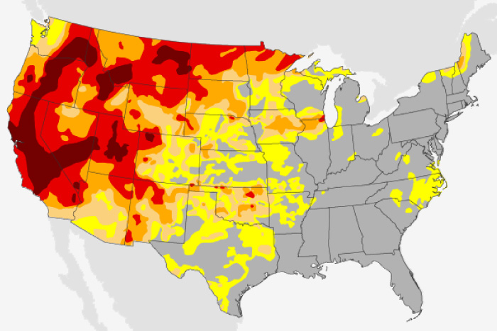
Warmth was widespread across the contiguous United States, while precipitation was a patchwork, with most of the drier-than-average regions in the already-parched West.
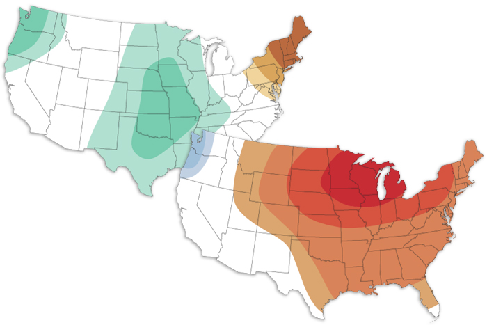
The October 2021 climate outlook favors a warmer-than-average month for the central and eastern United States and wetter-than-average conditions for the Plains.
Our interactive map shows the latest date of measurable snow recorded at thousands of U.S. weather stations, based on data through April 11, 2018.