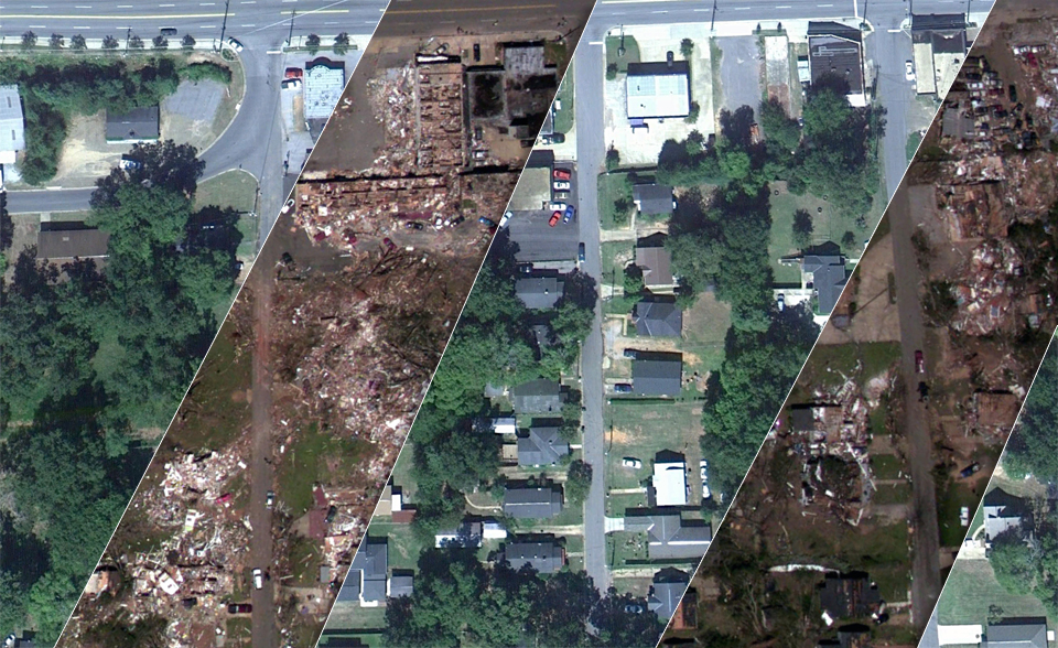
The tornado outbreak across the southern United States in late April 2011 was deadly, devastating, and record breaking. NOAA's "CSI" team is investigating the possible connections between global warming, natural climate patterns, and tornadoes.
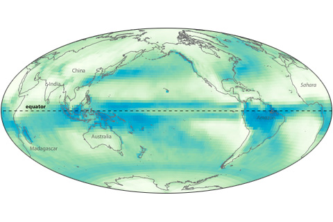
Near the Earth’s equator, solar heating is intense year round. Converging trade winds and abundant water vapor all combine to produce a persistent belt of daily showers known as the Intertropical Convergence Zone.
How did this year’s storms compare to the worst in recent history?
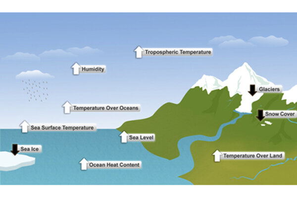
More than 90 percent of the warming that has happened on Earth over the past 50 years has occurred in the ocean. Not all of that heating is detectable yet at the surface
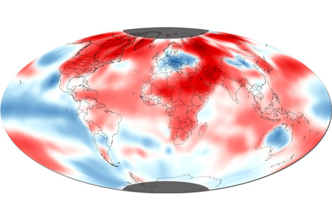
The average global surface temperature in October 2010 was 58.07°F (14.54°C), which is 0.97°F (0.54°C) above the historical average, according to the monthly assessment from NOAA's National Climatic Data Center.
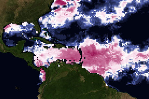
How do warm waters in the Caribbean this year compare to conditions in 2005, when high ocean temperatures triggered the worst mass coral bleaching event ever seen in the region?
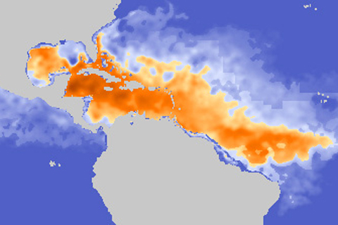
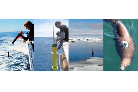
Identifying ocean areas with a deep layer of warm water—places that are storing large amounts of heat—is important for scientists trying to predict whether or not a hurricane will intensify.
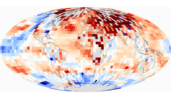
Each of the last three decades was warmer than all earlier decades in the instrumental record, and each set a new and statistically significant record, culminating in the 2000s, which was the warmest decade of all.
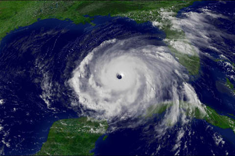
Christopher Landsea, of NOAA’s National Hurricane Center, works with tropical storm data and other hurricane experts to figure out how our warming world will affect hurricanes. Find out what current research tells us about hurricanes in the future.
State of the Climate in 2009
July 28, 2010