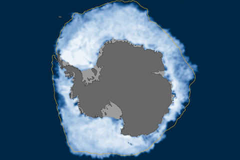
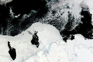
Antarctic sea ice extent set a new record high for daily extent on September 22, 2014. Climate scientists suspect the new record is linked to strong winds and melting ice shelves.
The annual minimum was 5.02 million square kilometers (1.94 million square miles), making 2014 the sixth smallest extent in the satellite era, which began in 1979.
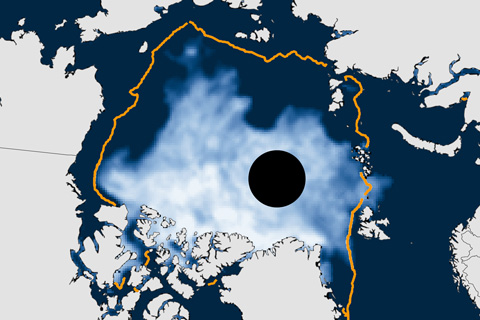
Arctic sea ice extent shrunk down to 2.0 million square miles (5.1 million square kilometers) in September 2013—18 percent below the 1981-2010 average, but larger than record low set in 2012.
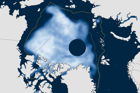
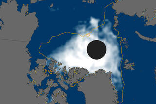
It’s finally here! Yesterday, scientists from the National Snow and Ice Data Center announced the ultimate sign of spring: Arctic sea ice reached its winter peak on March 21, 2014, and the annual melt season is underway.
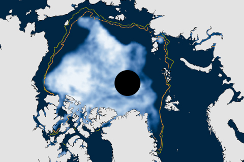
To be consistent with NOAA's use of 30-year periods for the official "climate normals," the National Snow and Ice Data Center switched its baseline period for sea ice analyses from 1979-2000 to 1981-2010. Compared to the new normal, the low ice conditions of the recent past will appear less abnormal than they used to.

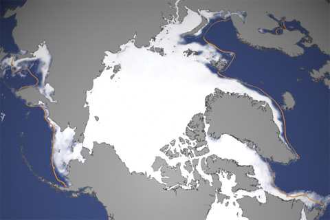
In 2012, sea ice melted to a record-breaking minimum extent. At the end of the summer melt season, ice covered only about half of the average area it did from 1979–2000.
Arctic Sea Ice Breaks 2007 Record Low
August 27, 2012
Since the mid-1950s, easy-to-serve, portion-controlled fish sticks have regularly found their way onto U.S. dinner tables and into school lunches. The past decade, however, has given fishermen and scientists a preview of the challenges they may face in keeping fish sticks on the menu as the planet gets warmer.

In September 2011, Arctic sea ice reached its second-lowest minimum extent in the satellite record.