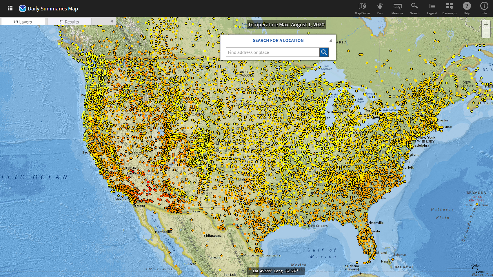
NCEI's Map Viewer Application presents a map interface to help users find, preview, and download climate and weather data. Users can also access some data through an ordering system: users submit their order and receive a link to download the requested data via email. Data ordered through the system are usually (but not always) delivered within a few minutes.
The interface is somewhat complex as it is designed to display a variety of data types in the same viewing environment.
Where do these data come from?
NOAA's National Centers for Environmental Information collects and archives data for the United States and the entire glove from across NOAA and its partner networks. Data are collected at weather/climate stations, from radars, weather balloons, moored buoys in the ocean, ships, airplanes, satellites, and from computer models.
-
How do I use the map interface to find and download data of interest?
- Open the Map Viewer Application and select the type of data you want from one of the tabs in the opening dialog. This will bring up a map showing locations for which those data are available.
- Enter a location to zoom the map to your area of interest, but don't bother clicking the red blinking dot on the map: it simply indicates the center of the area you entered. It does NOT represent a station with data.
- To get started selecting a location of interest, click the Wrench icon to open the Map Tools panel. If you want to view descriptions of layers, tools, and options, click the Help icon.
- Use any of the Map Tools to select stations of interest. Stations you select show up in the Results tab.
- For any station of interest, look to the right of its name for a Graph/Preview icon or Download icon. If present, click the graph for a preview the data or click the quick download icon.
- If these icons are not available, or you need to obtain certified documents, proceed to order the data using the free cart option. Enter your email to submit your order. You'll receive an email confirming your order followed by an email with a link to download the data you ordered.
For a step-by-step example of using the GIS data locator to obtain data, check the How-To tab in the Dataset Gallery entry for Daily Summary Observations
-
Data Format(s)TXT (ASCII), CSV, GeoTIFF, PDF, PNG, shapefile, TIFF, XML, Other
Access Type Link & Description Mapping Interactive map interface to help users find, preview, and download climate and weather data. Users can also access some data through an ordering system. -
Documentation Type Link & Description General Information about how to navigate the map interface, use its tools, interpret results, generate graphs, download data, and more. -
A collection of links, software, APIs, visualization methods, and other services to enhance data access, discovery, and interoperability of NCEI environmental data spanning a broad spectrum of scientific disciplines, archive methods, naming conventions, file formats, and governance strategies.
-
Data TypeLand-based station, Marine / Ocean, Model, Paleoclimate, Radar, Satellite, Severe weather, Weather balloonEssential Climate VariablesAir temperature, , , ,Science OrganizationNOAA NCEIEmailncei.orders@noaa.gov
 Click to see more detail