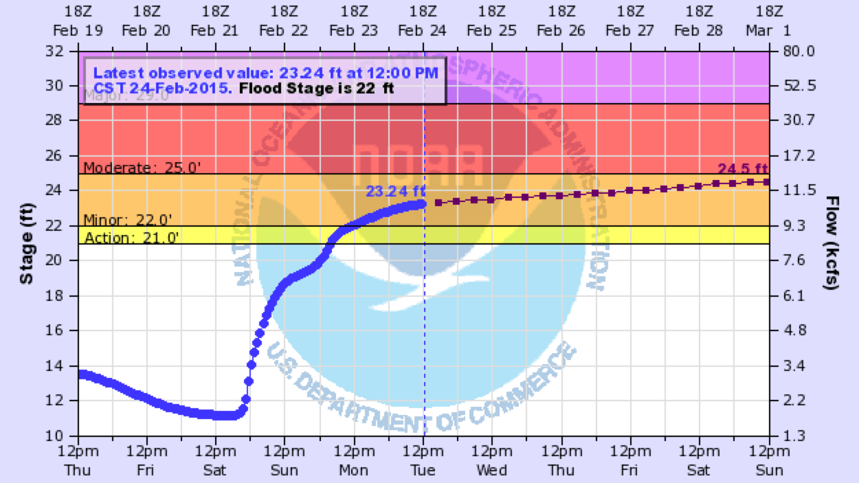
A color-coded map indicates current river levels or flood stages for more than 6,500 streamgages in U.S. states and territories. Zoom to a region of interest and hover over any dot to generate a hydrograph of recently observed water levels at that site. Some sites also offer water level forecasts for the next several days.
Where do these data come from?
The majority of water level observations come from the U.S. Geological Survey's national network of streamgages. Some real-time water level information comes from other federal, state, and local streamgage networks.
NOAA River Forecast Centers issue forecasts for some streams and rivers. Experts at these centers take into account how much precipitation has fallen in the recent past and precipitation amounts anticipated in the next 24 hours.
What can I do with these data?
- Monitor real-time development of flooding following storms or springtime melting.
- Compare current flow levels to peak levels during historic crests and record low-water events (listed on station pages).
- Combine information from precipitation, temperature, and snow depth to identify relative contributions to flooding from precipitation versus snowmelt.
-
How do I use the site?
- Zoom to a region of interest. Check the color coding of streamgage sites to identify sites with above- or below-average discharge.
- Hover your cursor over any streamgage site to view a graph of water levels for the past several days. Some stations also show forecast river levels several days into the future.
- Click any streamgage of interest to access additional information about that site.
- Explore the entire page to find dates and levels of historic crests and low-water events. Some pages also list specific local impacts associated with various flooding levels, and provide links to streamgages upstream or downstream from the site.
 Click to see more detail