Generate graphs that show cumulative snow water equivalent in river basins in western states of Alaska, Arizona, California, Colorado, Idaho, Montana, New Mexico, Nevada, Oregon, Utah, Washington, and Wyoming.
Where do these data come from?
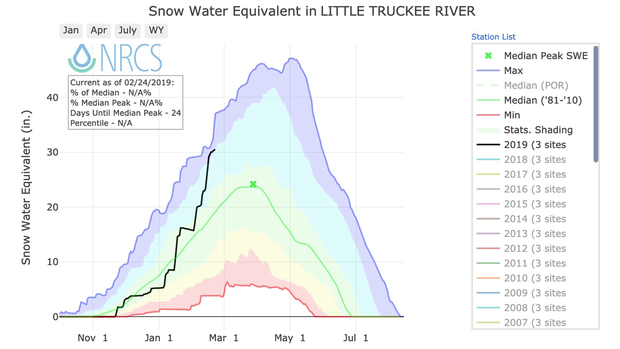
A network of Snow Telemetry sites—called SNOTEL—estimates snow water equivalent across basins by weighing the amount of snow that lands on pressure-sensitive snow pillows at stations across the west. Additional measurements come from automated stations and stations where people take manual measurements of snow.
-
How do I use the site?
- Start at the NRCS Snow Water Equivalent (SWE) Interactive Map.
- The map should default to SWE at the basin-level for the most current day, but can be adjusted in the right-hand panel.
- Use your cursor and left-hand navigation tools to locate an area of interest: then click on your desired basin.
- A pop-up will appear. Click the graph to go to an interactive version.
- When the graph shows up, check the legend to make sense of the shading.
- Click various years on the right to compare them with the overall distribution.
- Adjust the time slider at the bottom to examine only a portion of the data available.
 Click to see more detail
