
Image caption
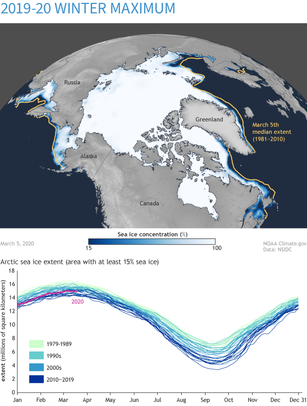
This map shows Arctic sea ice extent on the 2020 winter maximum, March 5, 2020. The graph compares sea ice extent over the 1981-2020 satellite record. NOAA Climate.gov based on data from NSIDC.
This website is an ARCHIVED version of NOAA Climate.gov as of June 25, 2025.
Content is not being updated or maintained, and some links may no longer work.
This map shows Arctic sea ice extent on the 2020 winter maximum, March 5, 2020. The graph compares sea ice extent over the 1981-2020 satellite record. NOAA Climate.gov based on data from NSIDC.