
Image caption
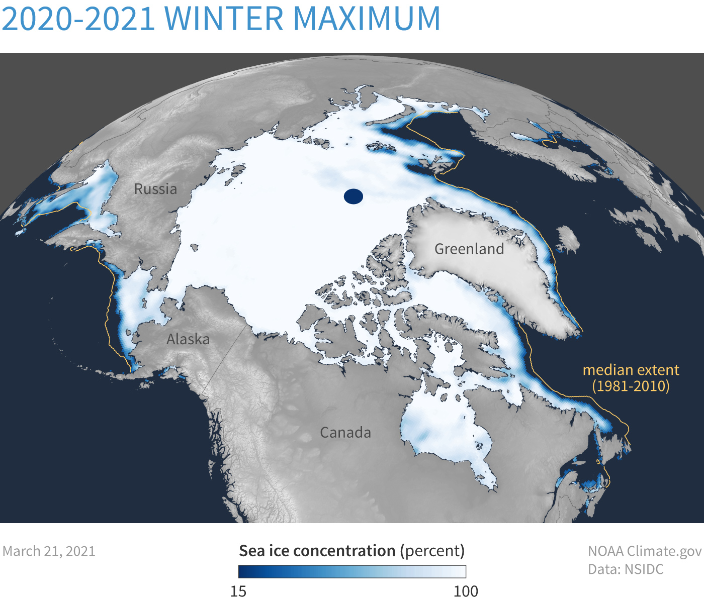
Sea ice concentration on March 21,2021—the day of the winter maximum extent. The gold line shows the median extent based on data from 1981-2020. Map by NOAA Climate.gov, based on data from NSIDC.
Sea ice concentration on March 21,2021—the day of the winter maximum extent. The gold line shows the median extent based on data from 1981-2020. Map by NOAA Climate.gov, based on data from NSIDC.