
Image caption
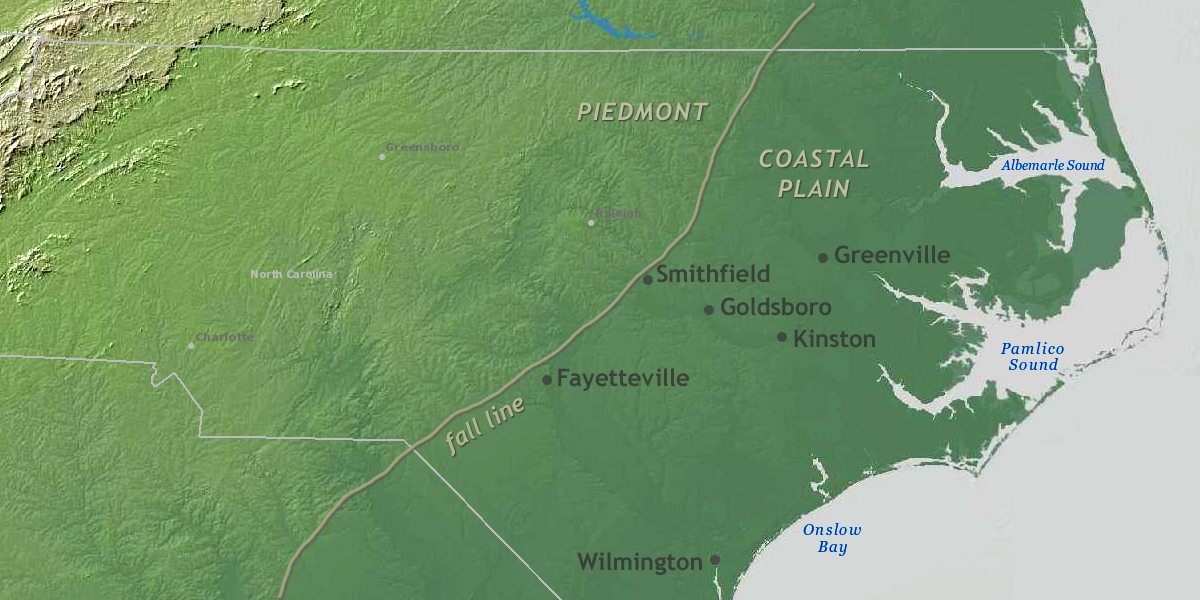
The fall line in North Carolina separates the Piedmont from the Coastal Plain. East of the line, there is little high ground, and many cities and towns sit in or next to the floodplains of the region's many rivers. NOAA Climate.gov image, adapted from digital elevation model data from NOAA NCEI's bathymetric data viewer.