
Image caption
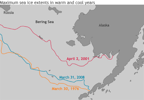
Spring ice extent in the Bering Sea varies a lot from year to year. The map shows maximum ice extent in 1976 (one of the largest ice extents on record), 2001 (a warm year), and 2008 (a more recent cool year). (Adapted from Figure 1 in Stabeno, Kachel, et al., 2012.)