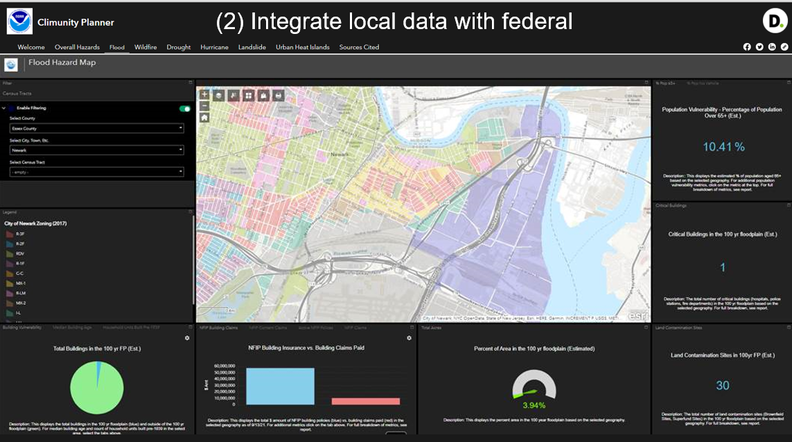
Image caption
This map from Deloitte’s Climunity Planning Tool shows relative flood risk overlaid with the locations of critical infrastructure throughout the region. At the perimeter of the map are charts and graphs showing metrics associated with flood insurance, such as the Number of Active Policies and the value of Building Insurance Coverage. The map and metrics together help users justify plans for flood mitigation projects.