
Image caption
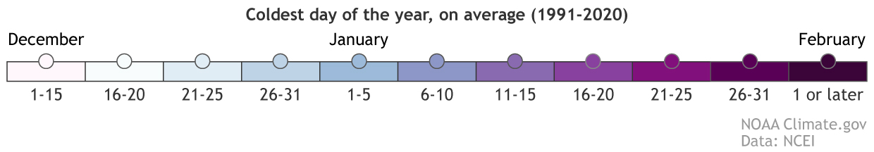
Click the plus sign (above) to zoom in. Click on a dot to see the data from that station. Launch in a full browser window. Based on the 1991-2020 U.S. Climate Normals, this map shows the typical coldest day of the year across the United States. Dots show observations from thousands of U.S. weather stations. The background map shows estimated (interpolated) values for areas between stations. NOAA Climate.gov map, based on data from NOAA NCEI. Static maps.