This website is an ARCHIVED version of NOAA Climate.gov as of June 25, 2025. Content is not being updated or maintained, and some links may no longer work.
File: PortFourchon_lostland1932-2010_HR.jpg
File name: PortFourchon_lostland1932-2010_HR.jpg
Original Resolution (pixels): 1440 × 988
File Size: 1388 KB (MIME Type: image/jpeg)
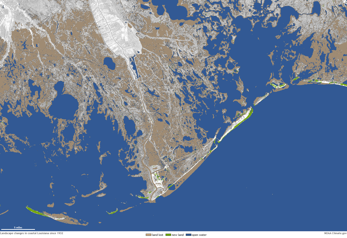
Alternate Text: Map showing difference in land areas near Port Fourchon between 1932 and 2011