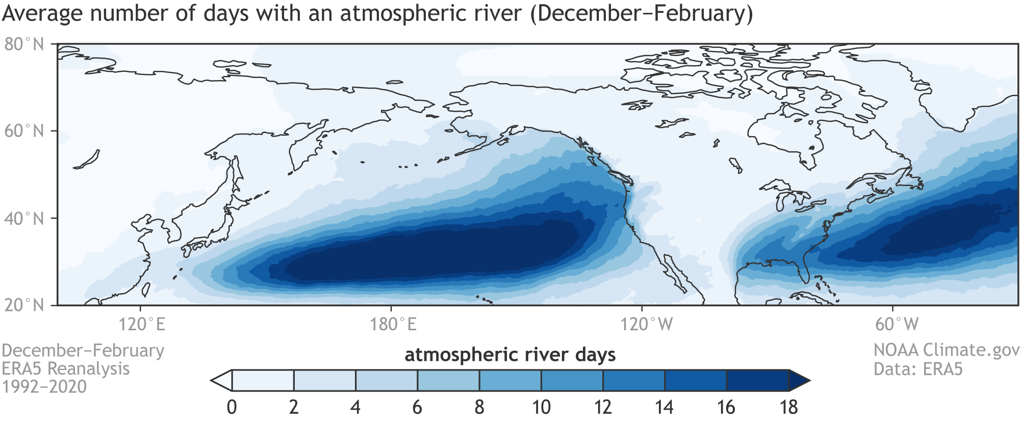
Image caption
Average number of days each winter (December–February) with an atmospheric river occurrence over the northeastern Pacific Ocean. Maps calculated with ERA5 Reanalysis data covering the 1992-2020 period and with the Mundhenk et al. (2016) method for detecting atmospheric rivers.