
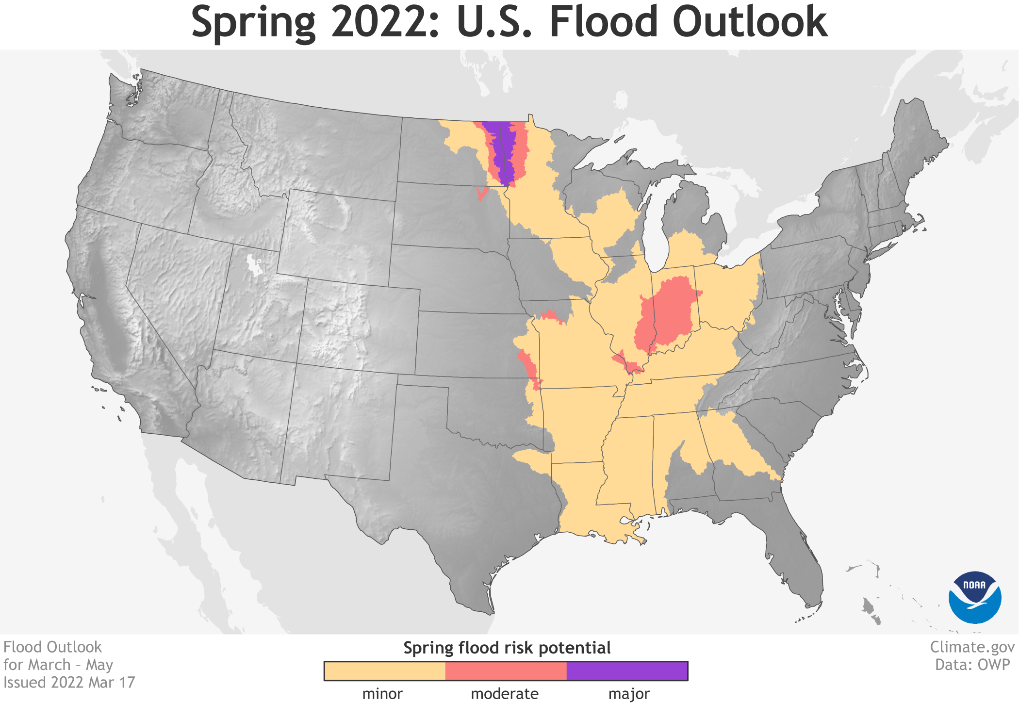
Image caption
Map showing parts of the United States with at least a 50 percent chance of minor (yellow), moderate (red), or major (purple) floods in March–May 2022. The risk of major flooding is confined to the northernmost Great Plains. Map by NOAA Climate.gov, based on data provided by the Office of Water Prediction.