
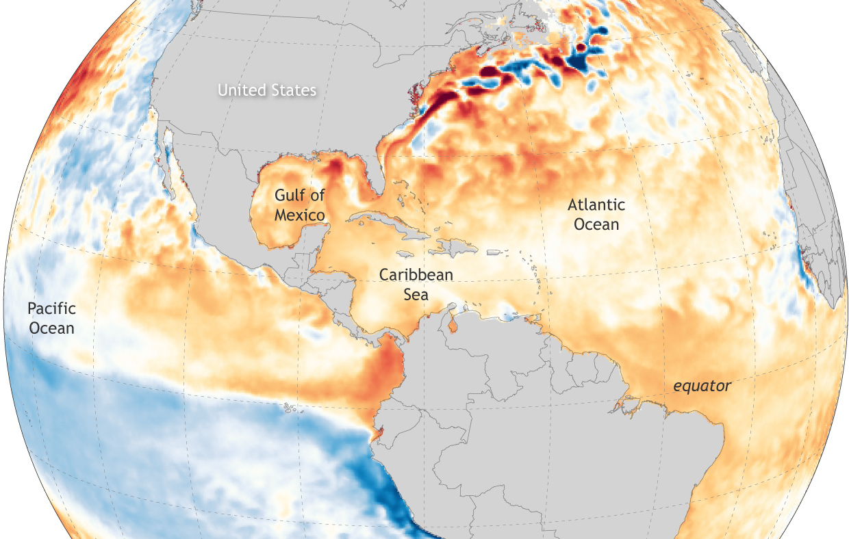
Image caption
Average sea surface temperatures across the Atlantic north of the equator, the Caribbean Sea, and the Gulf of Mexico were warmer than average (1985-1993) in April 2022—one of the factors contributing to the NOAA forecast of an above-normal hurricane season in the Atlantic. NOAA Climate.gov map, based on data from NOAA Coral Reef Watch project. Monthly images available from Data Snapshots.