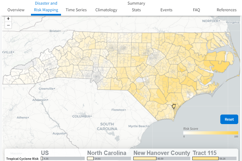
File name: B$D-NC_mapping_3x2.png Original Resolution (pixels): 837 × 558 File Size: 337 KB (MIME Type: image/png) Date Published: July 27, 2022 Alternate Text: Screenshot of diaster-mapping tool showing NC tropical cycle risks View image full size Download file
