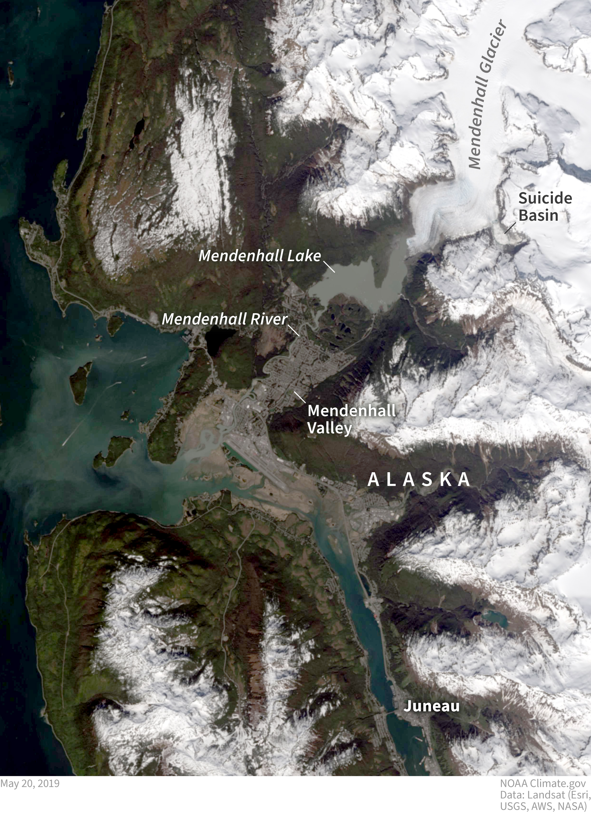
Image caption
The Mendenhall Glacier fills a large valley north of Juneau, Alaska, and creates an ice dam for a meltwater lake that fills Suicide Basin. Since 2011, outburst floods from the depression have been pouring into Mendenhall Lake and rushing down the river toward Juneau on a yearly basis. NOAA Climate.gov image, based on Landsat satellite data from May 20, 2019.