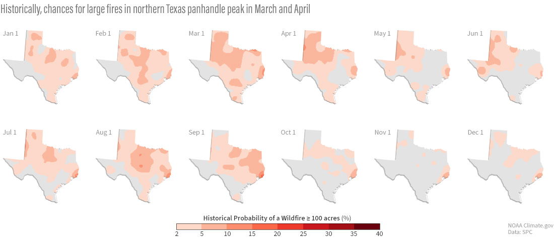
Image caption
Daily chances of a fire 100 acres or larger with 25 miles of a given location based on data from 1992-2015. NOAA Climate.gov maps, based on data from the NOAA Storm Prediction Center. View maps for each day of the year in our Data Snapshots collection.