
Image caption
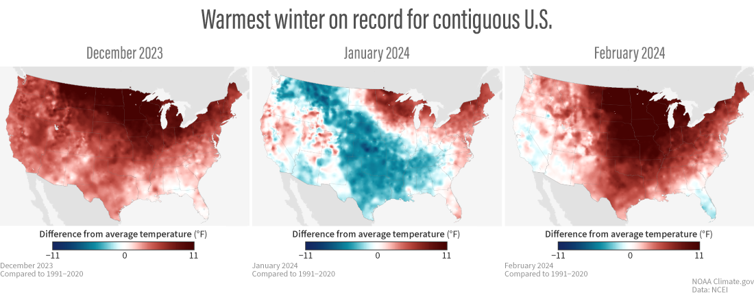
(left to right) Monthly temperatures for December, January, and February compared to the 1991-2020 average for the contiguous United States. Despite a swatch of cooler-than-average temperatures across the central part of the country in January, the winter overall was the warmest in the 130-year record. NOAA Climate.gov maps based on data from NOAA National Centers for Environmental Information (NCEI).