Image caption
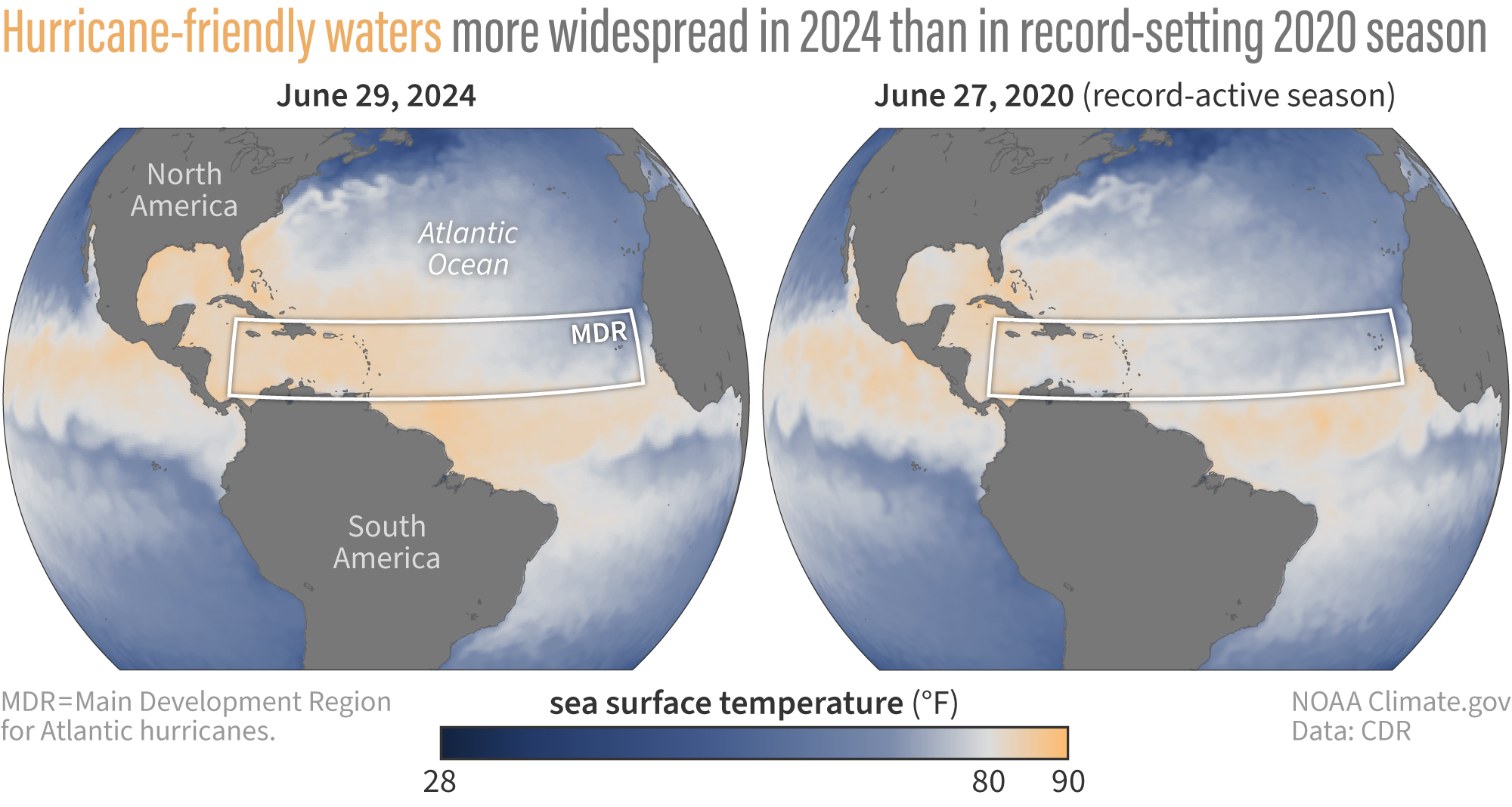
The map on the left shows the actual sea surface temperatures across the North Atlantic on June 29, 2024. The map on the right shows the actual sea surface temperatures across the North Atlantic on June 27, 2020. Areas in white and orange show where sea surface temperatures are above 80 degrees Fahrenheit (26 degrees Celsius)—the temperature needed to fuel hurricane development. The darker the orange the closer temperatures are to 90 degrees Fahrenheit (32 degrees Celsius). Much of the Atlantic Hurricane main development region (white box) has been record to near-record warm for much of 2024 through June. Temperatures across the Caribbean Sea and Gulf of Mexico were also warm enough to support hurricane development.