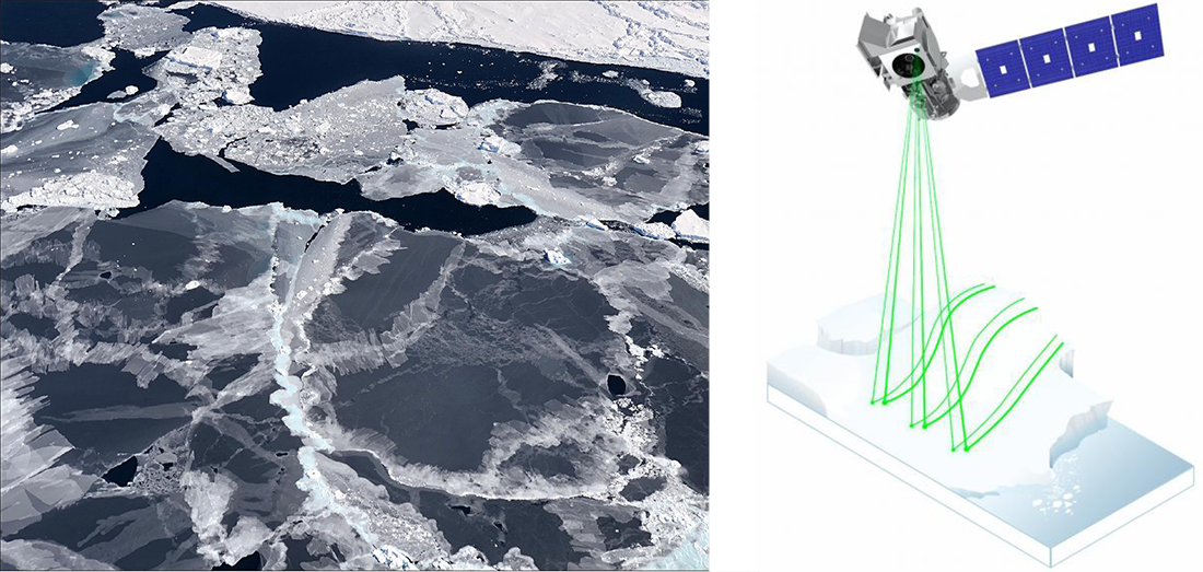
Image caption
Sea ice forms in open water. NASA's ICESat-2 satellite is able to detect the thin sea ice, allowing scientists to more accurately track seasonal ice formation. Both images courtesy of NASA.
This website is an ARCHIVED version of NOAA Climate.gov as of June 25, 2025.
Content is not being updated or maintained, and some links may no longer work.
Sea ice forms in open water. NASA's ICESat-2 satellite is able to detect the thin sea ice, allowing scientists to more accurately track seasonal ice formation. Both images courtesy of NASA.