
Image caption
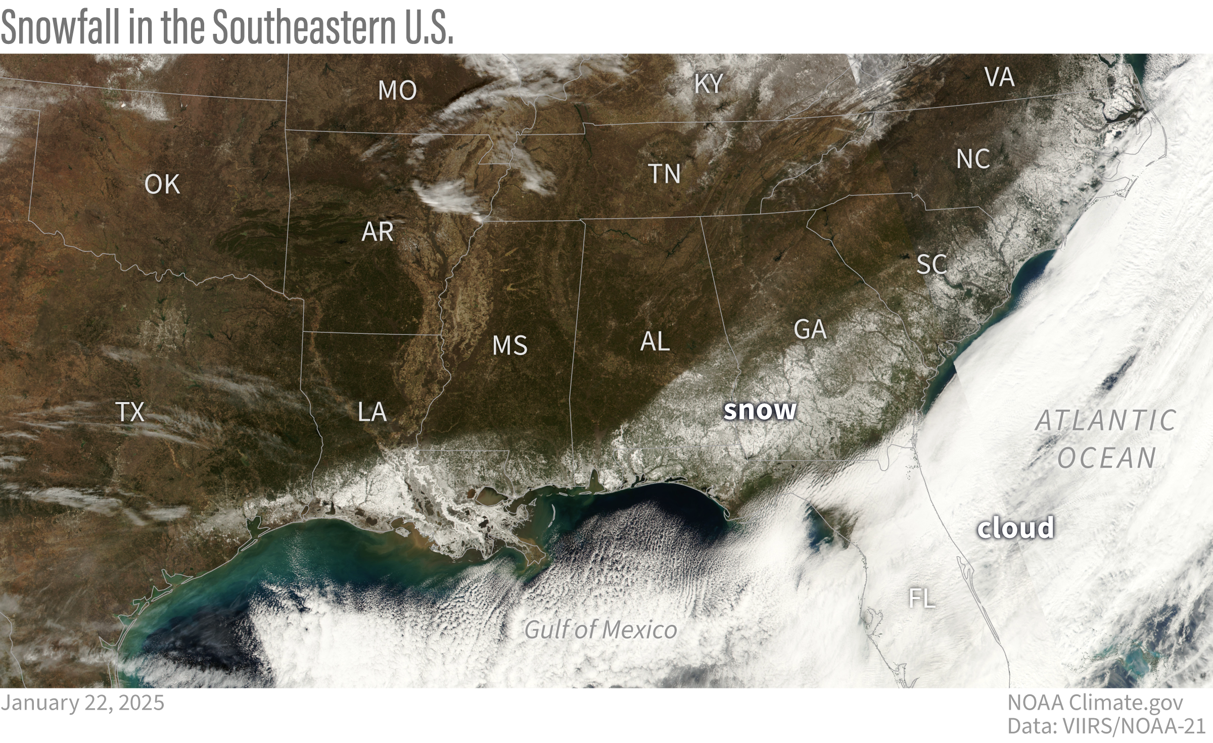
After the storm clouds cleared on January 22, 2025, satellites captured an unusual sight: a swath of snow arcing around the Gulf Coast and the Atlantic Southeast. Climate.gov image based on NOAA-21 satellite data from the VIIRS sensor.
This website is an ARCHIVED version of NOAA Climate.gov as of June 25, 2025.
Content is not being updated or maintained, and some links may no longer work.
After the storm clouds cleared on January 22, 2025, satellites captured an unusual sight: a swath of snow arcing around the Gulf Coast and the Atlantic Southeast. Climate.gov image based on NOAA-21 satellite data from the VIIRS sensor.