
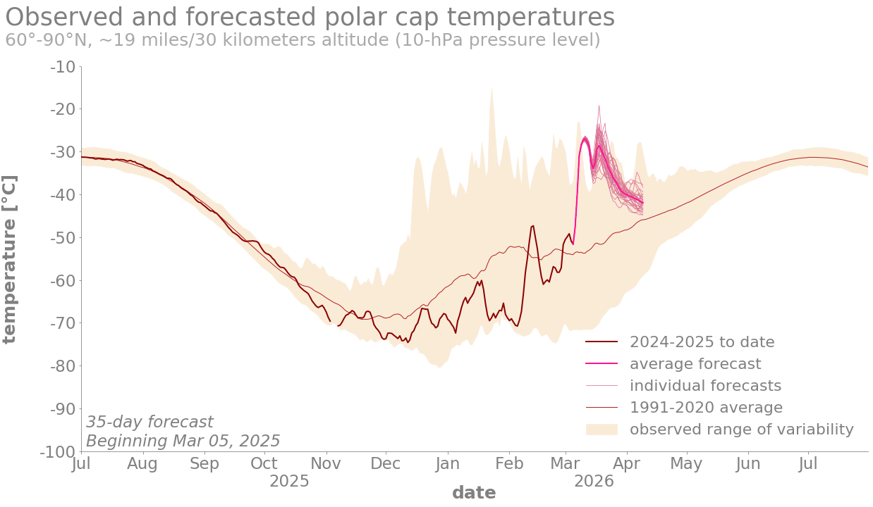
Image caption
Observed and forecasted (NOAA GEFSv12) polar cap temperatures compared to the natural range of variability (faint orange shading). Since October, these stratospheric temperatures (bold red line) have been colder than normal (thin red line). This is expected because strong polar vortex winds act as a barrier between cold Arctic air and warmer mid-latitude air. As the polar vortex becomes disrupted, the stratosphere will warm quickly and intensely (bold pink line), hence the name sudden stratospheric warming. NOAA Climate.gov image, adapted from original by Laura Ciasto.