
Image caption
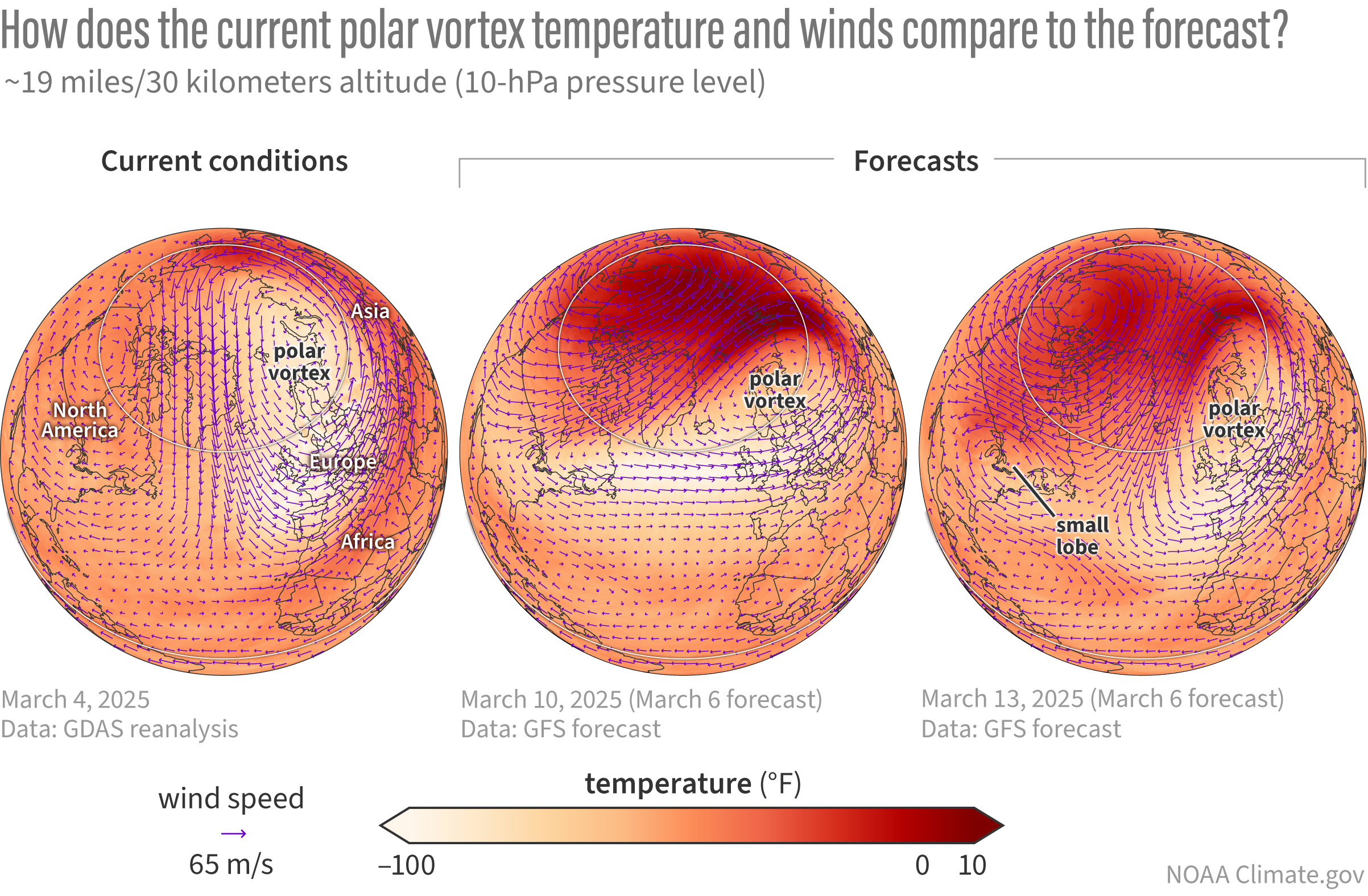
Evolution and forecast of stratospheric conditions. Earlier this week (March 4 2025; left panel), the polar vortex winds (vectors) were situated closer to the pole keeping the relatively cold air (light shading) isolated from the warmer surrounding air (orange/red shading). By March 10, 2025 (middle panel), the GFS forecast indicates the polar vortex will be nudged farther off the pole, with warmer air flooding the Arctic. The average winds around 60°N will become east-to-west, characterizing a sudden stratospheric warming. This disruption to the polar vortex is expected to continue through at least the next two weeks with smaller lobes of the vortex periodically splitting off (e.g., March 13, 2025, right panel). Current forecasts suggest that the stratospheric winds will not recover this spring and become west-to-east again. If so, this event will be classified as a final warming instead of a mid-winter sudden stratospheric warming. NOAA Climate.gov image, based on Global Forecast System data provided by Laura Ciasto.