
Image caption
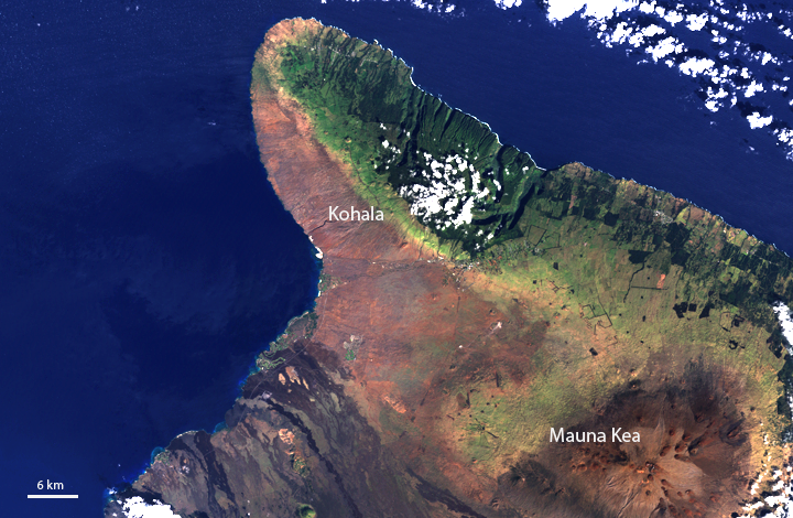
Ancient eruptions from the extinct 5,480-foot Kohala and the 13,796-foot dormant Mauna Kea Volcanoes shaped the mountainous northwest portion of Hawaii's Big Island, seen in this Landsat 7 satellite image from January 2001. Clouds hover over the lush, dark green forests on the rainier eastern slopes, while drier western slopes appear mostly earthy-brown. The sharp contrast in vegetation is called the rain shadow effect. Landsat data provided by the United States Geological Survey’s Global Visualization Viewer.