
Image caption
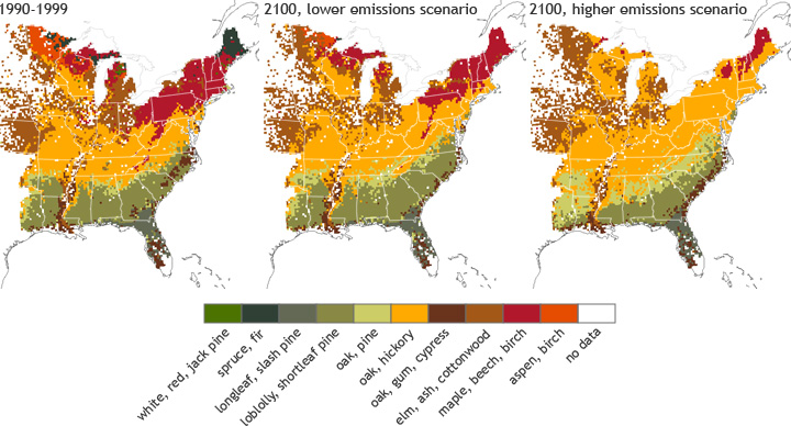
The map on the left shows the distribution of forest habitats across the eastern United States during 1990-1999. The maps at center and right show where suitable tree habitats will be in the future under two different scenarios of greenhouse gas emissions, one with lower (but still increasing) emissions and one with higher.