
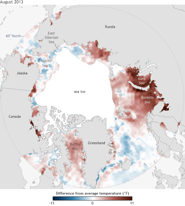
Image caption
Sea surface temperatures in August 2013 compared to the 1982-2006 average and August 2013 sea ice extent (areas with 15% or more ice cover, solid white). Map by NOAA Climate.gov, based on data provided by Wendy Ermold and Mike Steele, University of Washington; and National Snow and Ice Data Center.