
Image caption
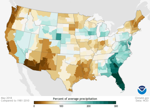
Difference from average (1981-2010) precipitation during May, June and July 2018 expressed as a percentage of average for each climate division in the United States. Brown colors reflect less than average precipitation while bluer colors reflect wetter than average conditions. While the western US observed generally below-average precipitation, the eastern US, especially the Mid-Atlantic observed wetter than average conditions. NOAA Climate.gov image using data from the National Centers for Environmental Information.