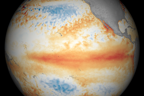
Temperatures across the tropical Pacific Ocean were warmer than average in March 2016.
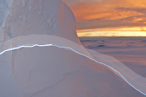
The 2016 winter maximum sea ice extent in the Arctic edged out 2015 to a set a new record low.
2016 Spring climate and flood outlook
March 16, 2016
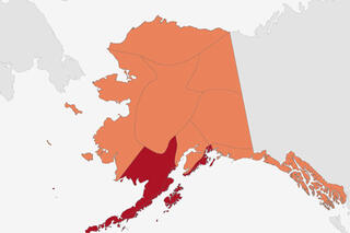
Where, oh where, has Alaska’s winter gone?
March 11, 2016
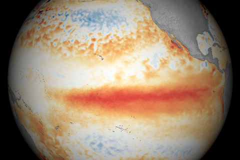
Waters along the equator in the Pacific Ocean were warmer than average during February 2016, but cooler than they were in January, according to satellite observations.
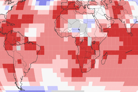
January 2016 became the ninth month in a row to set a new record-warmest monthly temperature.
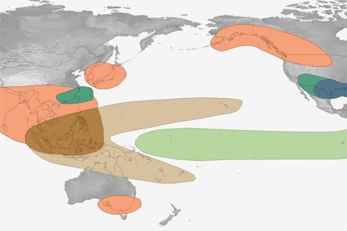
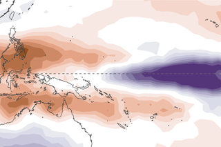
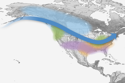
The disruptions of tropical Pacific sea surface temperature and rainfall that occur during the climate pattern called "ENSO" trigger a cascade of global side effects. These maps show how El Niño and La Niña affect seasonal climate around the world.
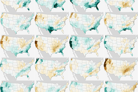
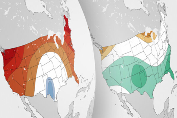
(UPDATED) Winter precipitation across the contiguous United States during every El Niño since 1950.
Free to good home! NOAA Climate.gov provides hundreds of images and maps that are free for re-use. This page gathers up links to our most popular El Niño and La Niña images.