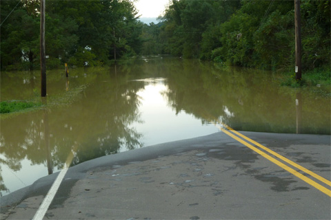
The remnants of Tropical Storm Lee brought record rainfall amounts to the East Coast in the first week of September, swelling rivers and forcing evacuations in some areas of Pennsylvania and New York.

Maps of locations where heat records were broken in summer 2011 make a nearly complete picture of the United States.
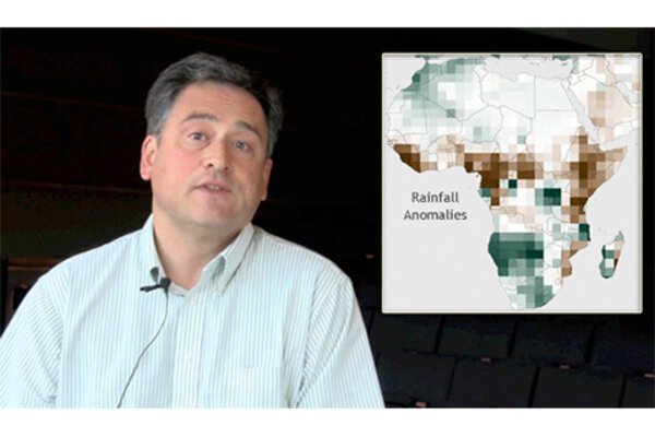
Satellites Critical for Drought Monitoring in East Africa
September 7, 2011
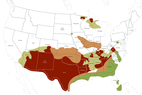
In summer 2011, the South was in the grip of one of the worst droughts on record, and the fall drought outlook issued by NOAA’s Climate Prediction Center provided little hope of relief, especially for the Southwest and Texas.
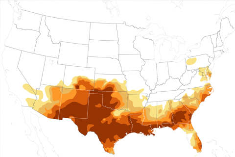
At the peak of this year’s drought, a record 12 percent of the U.S. was experiencing exceptional drought conditions.
How do warm waters in the Caribbean this year compare to conditions in 2005, when high ocean temperatures triggered the worst mass coral bleaching event ever seen in the region?
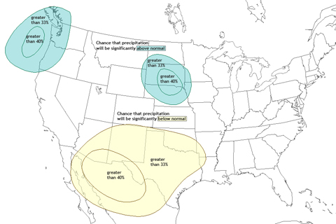
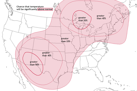
After enduring months of drought and baking summer heat, residents of the Southwest and Southern Plains will hardly be excited about the fall 2011 temperature and precipitation outlooks.

NOAA 2010 Hurricane Outlook
August 25, 2011
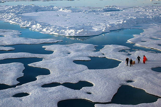
Each summer, the seasonal unraveling of the Arctic’s blanket of ice exposes large areas of the ocean to solar heating. The smaller the ice extent, the larger the potential warming influence. Arctic sea ice extent in July 2011 was the lowest for that month in the satellite record.

A map of each location where a daily heat record was broken in July 2010 creates a nearly complete image of the contiguous United States.