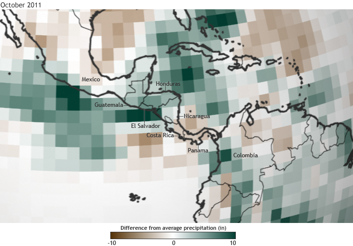
Torrential Rains in Central America
Details
From October 10-20, 2011, two separate storm systems dumped nearly five feet of rain across southern Central America, causing flooding and landslides in several areas.
The map above shows the difference from average precipitation across Central America for October 2011. Shades of brown indicate areas that received up to 10 inches less than average precipitation for the month while green indicates up to 10 inches more than average. Light colors show where precipitation totals were near the long-term average.
Honduras, Costa Rica, Guatemala, El Salvador, Nicaragua, and southern Mexico were particularly hard hit. At least 105 people lost their lives and over 1.5 million people in the region were affected, according to United Nations reports.
Map by Hunter Allen, based on daily composites of precipitation data from the NCEP/NCAR Reanalysis project, provided by NOAA Earth System Research Laboratory. Reviewed by Jessica Blunden and Deke Arndt.
