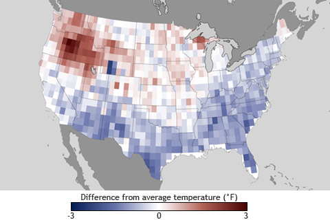
According to NOAA’s Climate Prediction Center, weak El Niño conditions may develop this fall. How might a full-fledged El Niño event this winter influence weather where you live?

In a place routinely afflicted by drought, water managers in Tampa Bay use climate forecasts to ensure a water supply to people’s taps without sucking the region’s rivers, wetlands, and groundwater dry. The limits of their innovation might be tested in a future which could pose even more challenges to ensuring the oasis remains green.
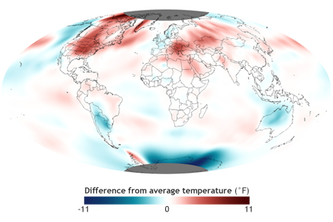
The average global temperature for July 2012 was more than 1° Fahrenheit above the 20th-century average, making it the fourth warmest July since record keeping began in 1880
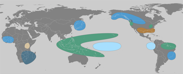
The lead character in the 2011 climate story was La Niña—the cool phase of the El Niño-Southern Oscillation—which chilled the central and eastern tropical Pacific at both the start and the end of the year. These natural cooling events have a long reach: many of the big climate events of 2011, including famine-inducing drought in East Africa, an above-average hurricane season in the Atlantic, and record rainfall in many parts of Australia, are common “side effects” of La Niña.
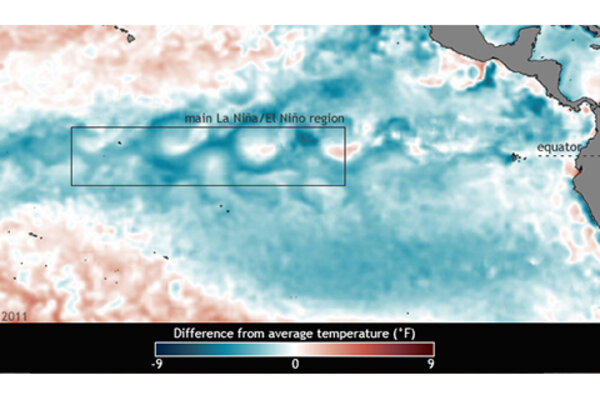
Double-dip La Niña in 2011
July 10, 2012
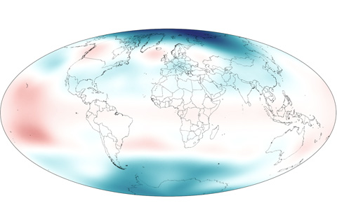
In early 2011, stratospheric temperatures rose over the tropics due to La Nina while temperatures over the poles fell below the long-term average.
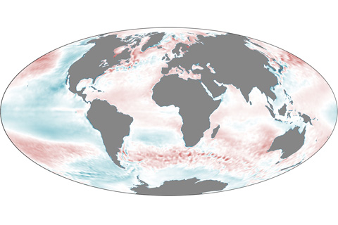
In 2011, La Niña and the Pacific Decadal Oscillation cooled parts of the Pacific Ocean, but unusually warm temperatures predominated elsewhere.
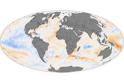
Except for some La Niña-cooled regions of the tropical Pacific and a few other cool spots, the upper ocean held more heat than average in 2011 in the Pacific, Atlantic, Indian, and Southern Oceans.
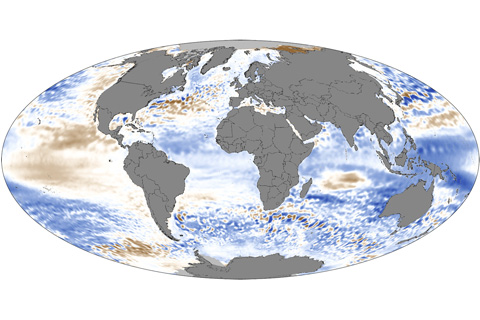
In 2011, global sea levels fell below the long-term trend of sea level rise, but as La Niña waned late in the year, global ocean levels began rising rapidly.
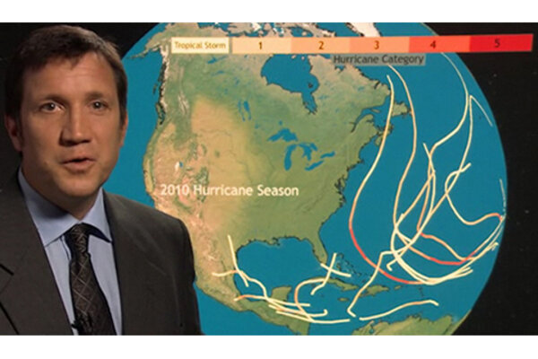
Balancing Forces: Normal 2012 Hurricane Outlook
June 19, 2012