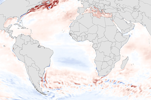
Sea surface temperature—the average temperature of water at the surface of the global ocean—is a key indicator of the ocean's status.

Sea surface temperature—the average temperature of water at the surface of the global ocean—is a key indicator of the ocean's status.

In 2012, sea ice melted to a record-breaking minimum extent. At the end of the summer melt season, ice covered only about half of the average area it did from 1979–2000.
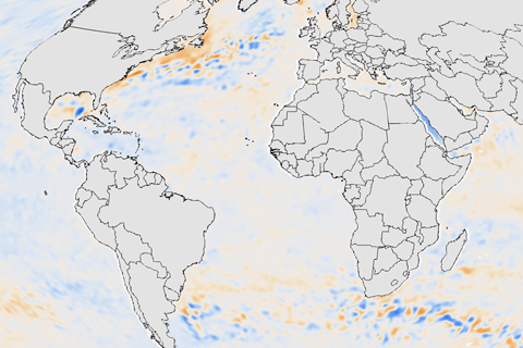
The ocean’s ability to store and release heat over long periods of time gives it a central role in stabilizing Earth’s climate system. But when the ocean absorbs more heat than it releases, its heat content increases. Warming causes water to expand, raising global sea level. Higher water temperatures can also threaten marine ecosystems, disrupting fisheries and the people who depend upon them. The upper ocean held more heat than average in 2012 in most of the major ocean basins, with the exception of the Pacific Ocean.
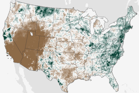
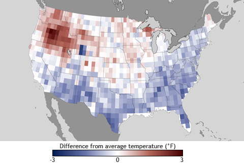
They say the grass is always greener on the other side of the fence, and that was certainly true in June. Throughout the month, two very different stories played out in the contiguous United States. While the drought-stricken West fell into the grips of an intense heat wave, East Coasters were bombarded by summer thunderstorms.
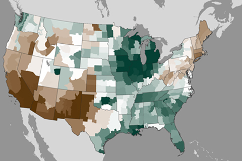
April showers and cool temperatures brought drought relief to many areas across the United States, but conditions worsened in the Southwest.
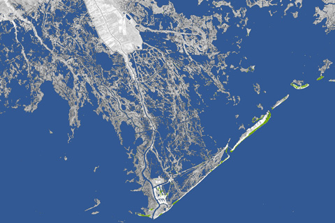
Every year, 25-35 square miles of land off the coast of Louisiana—an area larger than Manhattan–disappears into the water due to a combination of subsidence (soil settling) and global sea level rise. Toggle these maps back and forth to see how much land has been lost to the Gulf of Mexico in the past 80 years.
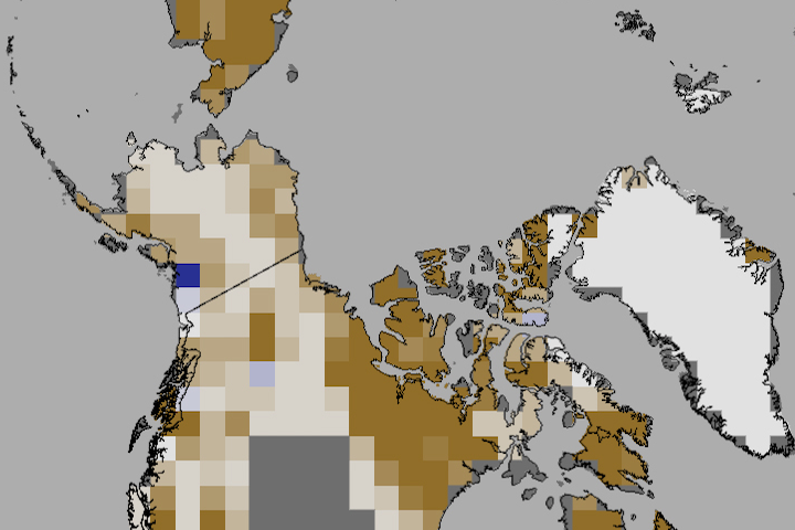
In June 2012, snow cover extent over Eurasia and North America hit a new record low. It is the third time in five years that North America has set a new record low, and the fifth year in a row that Eurasia has. The rate of snow cover loss over Northern Hemisphere land areas in June between 1979 and 2012 is -17.6% per decade—a faster decline than September sea ice loss over the same period.
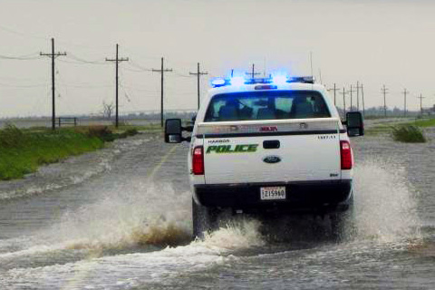
At the edge of southern Louisiana sits Port Fourchon—the hub through which 20 percent of our nation’s oil and gas supplies are distributed to the rest of the country. The only road leading to and from this major port is the Louisiana-1 Highway. A drive down the LA-1 through a vulnerable but vibrant coastal landscape shows what is at stake if ‘America’s longest main street’ fails to stay above water.
As March began, people living the eastern United States were enjoying warmer temperatures, budding flowers, and other signs of the approaching spring season. But on the opposite coast, a series of wintry storms rolled through the already snow-packed Cascades, leaving behind several feet of powder and sparking avalanche warnings throughout the region.
According to NOAA’s Climate Prediction Center, weak El Niño conditions may develop this fall. How might a full-fledged El Niño event this winter influence weather where you live?