ENSO Blog
Given the relatively high probabilities for El Niño in our team’s April 2023 ENSO update, I decided to team up with some of my scientific colleagues, Antonietta Capotondi (NOAA Physical Sciences Laboratory and University of Colorado, Cooperative Institute for Research in Environmental Sciences) and Aaron Levine (@afzlevine, University of Washington, Cooperative Institute for Climate, Ocean, and Ecosystem Studies), to explain why making ENSO forecasts during the Northern Hemisphere springtime generally makes us want to skip the forecast. But we, of course, cannot because if a decent-sized El Niño is going to form, it is probably going to form in the spring or summer. Which means as much …
Read article
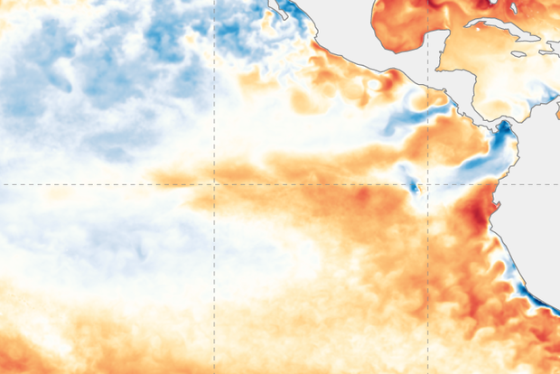
Well, that was quick! Just two months ago I was writing about La Niña for what seemed like the 97th month in a row, and then by March La Niña had departed. Today we’re hoisting an El Niño Watch, meaning that conditions are favorable for the development of El Niño conditions within the next 6 months. In fact, there’s a 62% chance of El Niño conditions for the May–July period. Read on for the reasoning behind the outlook, thoughts about the potential strength of El Niño, and implications for global weather and climate.
Let’s run some numbers
The March average sea surface temperature in the Niño-3.4 region, our primary monitoring region for ENSO (El Niño/Southern Oscillation, the whole El…
Read article
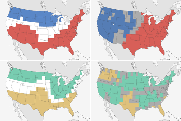
Don’t look now, but it’s winter outlook verification time! A time when I like to take readers on a statistical sojourn, a mathematical migration, through last year’s winter outlook. By the end of this post, you’ll have been provided with a non-alcoholic, numbered nightcap in the form of an answer to the question “How did the winter outlook do?” (Sorry. I’m in an alliterative mood.)
But first, my yearly warning that some math is involved in this post. Because while it may be easiest to just use our eyes to verify whether the forecast map matched the real winter, our eyes can lie. Plus, we aren’t looking for an easy way out. We’re the ENSO Blog, and you are ENSO Blog readers, for Pete’s sak…
Read article
La Niña—the cool phase of the El Niño-Southern Oscillation (ENSO) climate pattern—has left the building! After a year and half of non-stop La Niña, the tropical Pacific ocean-atmosphere system has transitioned to neutral, allowing NOAA to issue its “Final La Niña Advisory”. What can we expect for ENSO through the summer and into next fall and winter? I’ll get to that!
Get outta town
First, though, let’s bid La Niña adieu. The most recent weekly measurement of the sea surface temperature in the Niño-3.4 region (our primary monitoring region for La Niña and El Niño) was a mere -0.2°C (-0.4˚ F) compared to the long-term average. (To calculate a change in temperature in degrees Celsius to …
Read article
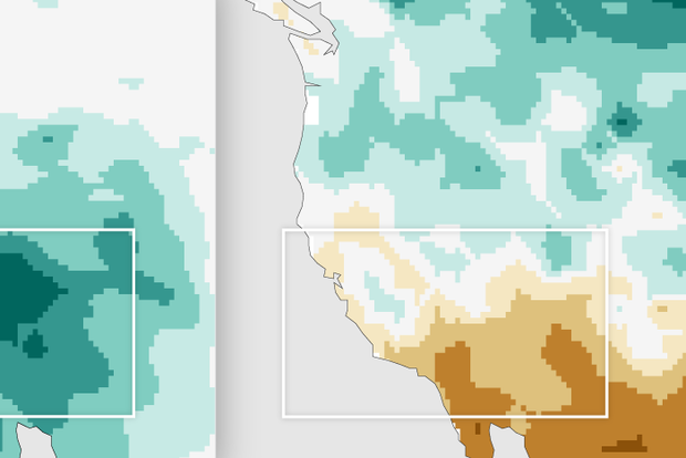
Another meteorological winter is drawing to a close, though it feels like some of us in the East are still waiting for winter to arrive (not a single inch of snow here in central New Jersey so far!). I realize that this winter has been more eventful in other parts of the country, notably in the western U.S., where torrential rains and heavy mountain snows occurred in December and January. Such heavy precipitation was unexpected prior to the season in a region afflicted with a multi-year severe drought, especially given that we are in the third consecutive winter of La Niña. How unusual were these Southwestern wet conditions in the first two-thirds of a La Niña winter? And did tropical sea su…
Read article


