Blogs
We live in a warming world. And we often characterize that warming through metrics of temperature. But that’s only a sliver of the story. Another sliver, and perhaps a more consequential one, of the story is the connected increase in atmospheric moisture.
Recent months have brought us—yet again—real-world examples of what these increases in moisture can bring.
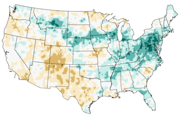
To say it’s been a wet year in the mid-Atlantic is an understatement. Through August, that is to say, before Florence, we were already working on the wettest year on record, or close to it, in much of the region.
Once Florence’s rains are factored into the end-of-September analyses, we’ll see much more dark green in the So…
Read article
What’s happening in the exciting world of ENSO prediction? I’ll tell you! While neutral conditions reign right now, we’re still expecting El Niño conditions to arrive later this fall (50-55% chance). By winter, the chance of El Niño conditions increases to about 65-70%.
The now
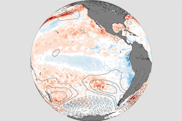
Things are definitely looking pretty neutral right now in the tropical Pacific. The most recent weekly temperature in the Niño3.4 region, our primary index for monitoring the El Niño-Southern Oscillation (ENSO), was 0.3°C above the long-term average. Most of the equatorial Pacific surface water temperatures are slightly above average, while some areas of slightly cooler-than-average sea surface waters have recen…
Read article
This is a guest post by Prof. Benjamin Kirtman, at the University of Miami, who is the Director of the Cooperative Institute for Marine and Atmospheric Studies (CIMAS) and of the Center for Computational Science Climate and Environmental Hazards Program. His research focuses on understanding climate predictability from days to decades using a suite of climate models. Also, he has played a key leadership role in the North American Multi-Model Ensemble (NMME) and the Subseasonal Experiment (SubX) projects.
A Flooded Future
As residents of South Florida, we are confronted with the profound challenge of sea level rise due to our warming climate…
Read article
By nearly all measurements, the tropical Pacific is comfortably gliding along in ENSO-neutral conditions, and forecasters expect that will continue through the rest of the summer. The chance that our old buddy El Niño will be around during the fall is about 60%, rising to 70% by winter, and the El Niño Watch is continued this month.
The price is right
Let’s get started with four contestants from the audience. If you’re a Pacific Ocean ENSO indicator, come on down! The latest weekly Niño3.4 index was just 0.1°C above the long-term average. This is actually a little bit lower than the previous few weeks, but it doesn’t mean that El Niño is less likely. ENSO is a seasonal phenomenon, mean…
Read article
This is a guest post by Prof. Jason C. Furtado (@wxjay) of the University of Oklahoma School of Meteorology. His research group focuses on large-scale climate dynamics and applying that knowledge to subseasonal-to-seasonal forecasting, testing and evaluating operational and climate models, and future climate change.
In case you haven’t heard, there is now a 70% chance of an El Niño this winter. Having a confident prediction of El Niño this far ahead is quite a feat for the seasonal forecasting community. One reason ENSO is predictable six to nine months ahead of time is the North Pacific Oscillation (NPO) (1) and the related Pacific Meridional Mode (2). But, these precursors ar…
Read article


