Blogs
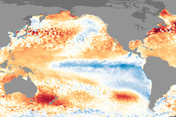
Many thanks to Tom for covering my post last month, allowing me to focus on the American Meteorological Society’s annual meeting (where I talked about the blog, and enjoyed my company on the plane ride home). It’s good to be back, and I’m glad to see our La Niña is still hanging around… although probably not for much longer. In fact, the current ENSO forecast from the Climate Prediction Center and IRI predicts a 55% chance that neutral conditions will be in place by spring 2018. Let’s get to it!
Sea shanties
During January, the sea surface temperature in the Niño3.4 region of the tropical Pacific—our primary measurement for ENSO’s ocean component—was close to 1.0°C cooler than the long…
Read article
Currently, we are fully immersed in the second winter of a “double-dip” La Niña. Although it will take some time before we can see how this event stacked up with past events, you might have noticed that it has been quite dry over much of the U.S. this winter, with drought expanding across several regions, particularly in the south. Being the big ENSO fans that you are, you might have asked yourself, are these conditions typical in the second winter of a double-dip La Niña? And are there any differences in how the atmosphere responds to La Niña in the second winter relative to the first? Well if either of those questions ever crossed your mind, then you’re i…
Read article
* {
margin: 0;
padding: 0;
}
.media-image_one {
height: 350px !important;
}
.media-image_two {
height: 680px !important;
}
#page-wrap {
width: 620px;
margin-left: 0px;
position: relative;
}
a {
text-decoration: none;
color: black;
}
.image-link {
display: block;
width: 620px;
height: 320px;
position: absolute;
top: -360px;
left: 0px;
}
.image-link_two {
display: block;
width: 620px;
height: 650px;
position: absolute;
top: -680px;
left: 0px;
}
#one {
background: url(/sites/default/files/Sacramento_cummulative_precip_linegraph_620.jpg) no-repeat;
z-index: 5;
}
#two {
background: url(/sites/default/files…
Read article
In the last few weeks, my colleague Karin Gleason and her colleagues around the country finalized a number of state climate extremes records and reports. Some of these were recent record-breaking events; some were recently discovered as data continue to be liberated from paper into the digital world; and some were backlogged because somebody had let them linger too long (here’s where I blush and stare at my shoes).
Here’s what Karin and Friends determined in the last month or so:
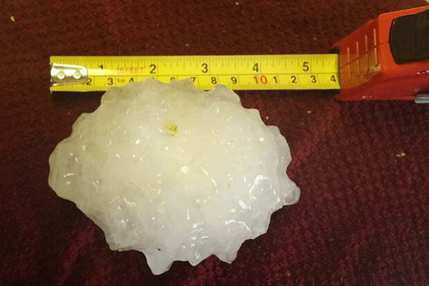
The 4.75” diameter hailstone that fell in Minooka, Illinois, in June 2015 was indeed the largest retrieved and reported in the Illinois record.
The 199 mph wind gust observed on Ward Peak in Febr…
Read article
Now that we are smack dab in the middle of winter in the Northern Hemisphere, the time of year when ENSO tends to have its more reliable impacts in the United States, it’s go-time for paying attention to what’s going on in the Pacific. And the latest CPC/IRI ENSO forecast says…[drum roll please]…La Niña is here to stay for this winter with a 85-95% probability before transitioning to ENSO-Neutral conditions during the spring.
Sidenote: Also, who is this person writing this post who is definitely not Emily? I’m Tom and I’m filling in for Emily this month (see footnote for Emily’s whereabouts). And just like a normal substitute teacher, don’t be surprised if I end this article early and jus…
Read article


