Blogs
Two weeks ago, I wrote about 2015’s chances of dethroning 2014 as the warmest year on record and how the maturing El Niño increases those odds.
This week, going Beyond the Data, we’ll unpack what that first-place ranking really means. In the big picture, the actual rank of an individual year isn’t that important. In fact, using ranks can really over-emphasize their importance. So why do we use them?
The Power of Context
Let’s start with something light, like some [really amateur] comparative psychology. As animals, we use real-time information to identify threats. This keeps us (and bears) from walking into fires. As humans, we seek patterns. It’s what we do. We thrive…
Read article
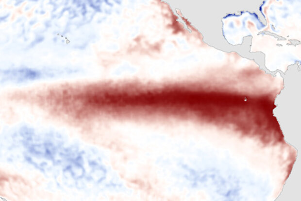
El Niño continues to pick up steam. NOAA CPC/IRI forecasters are now very confident that the event will continue through the fall (over 90% chance) and into the winter (~85% chance). Now that we’re emerging from the spring barrier, this month’s update provides a first guess of the potential strength of El Niño. It’s harder to predict the strength of the event than it is to predict its duration, so we are less confident about that, but forecasters currently favor a “strong” event for the fall/early winter. By “strong” we mean it’s expected that the three-month average sea surface temperature in the Niño3.4 region will peak at more than 1.5°C (2.7°F) above normal.
What’s happening right now…
Read article
Earlier this spring, our (older) sister blog announced that El Niño is here. That has significant ramifications for parts of the world, because El Niño changes their odds of certain seasonal outcomes (wet, dry, warm, cool), especially if it maintains its strength, or strengthens further, and if it persists beyond our summer. That’s all detailed over at The ENSO Blog.
But why are climate scorekeepers like me interested in El Niño? Well, beyond the immediate influences on regional outcomes, it turns out that El Niño can push the needle on global temperature as well. The arrival of El Niño raises the chances of setting a new record-warmest global temperature for any time period. Just i…
Read article
In the recent ENSO Diagnostic Discussion, the probability of El Niño during this Northern Hemisphere summer (June to August) exceeds 90%. As of late May, weak to moderate El Niño conditions are already here, both in the oceanic and atmospheric aspects. And many ENSO prediction models are calling for the sea surface temperature (SST) anomalies to increase during the next several months.
Usually, El Niño or La Niña episodes attain peak strength in autumn or early winter (1), and climate impacts in the mainland US are most reliable during winter—just a bit later than peak time. Last June, Mike Halpert described the expected effects of El Niño in the US during winter. But because the Nino3.4 …
Read article
Hi, and welcome to Beyond the Data: A blog by the nation’s official climate record keepers. As our fancy tagline suggests, the authors of this blog are charged—with our wonderful colleagues—to keep the records of the nation’s and the world’s climate system.
In the way of introductions, here’s a little more about each of us:
Dr. Jessica Blunden authors NOAA’s monthly global climate reports. A North Carolina native, she’s a graduate of Appalachian State University and earned her doctorate at North Carolina State University, where she focused on atmospheric chemistry and air quality. She’s served five consecutive years as the lead editor of the Bulletin of the American Meteorologi…
Read article


