Blogs
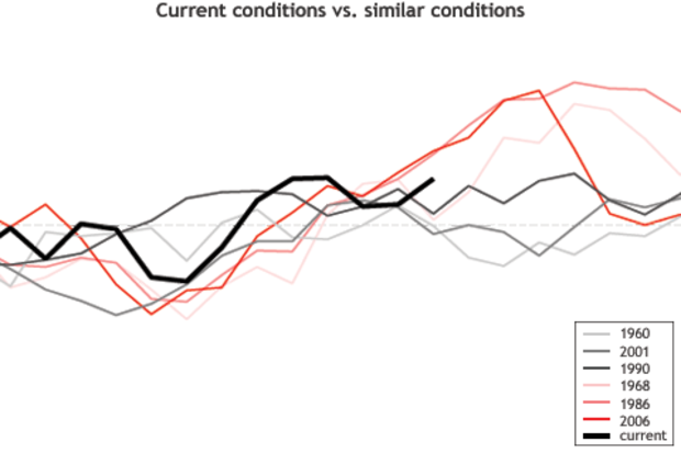
Lately, many of us are wondering if a 2014-15 El Niño is going to materialize, and if so, how strong it might become and how long it will last. It might cross some folks’ minds that the answer to these questions can be found by collecting past ENSO cases that are similar and see what happened. Such an approach is known as analog forecasting, and on some level it makes intuitive sense.
In this post, I’ll discuss why the analog approach to forecasting often delivers disappointing results. Basically, it doesn’t work well because there are usually very few, if any, past cases on record that mimic the current situation sufficiently closely. The scarcity of analogs is important because dissimil…
Read article
This is a guest post from Richard P Allan, who is a professor in the Department of Meteorology at the University of Reading/UK. He is a lead investigator of the DEEP-C project and tweets at @rpallanuk . This guest post reflects one interpretation of this expansive topic, which like all cutting-edge science, will be revised and updated as new observations and analysis arise.
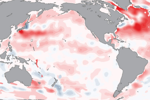
It is well known that the surface has warmed over the past few decades, primarily in response to rising concentrations of greenhouse gases. ENSO variability and other natural factors, have additionally contributed toward year-to-year fluctuations about this warming trend (dark red line in Figure 1). …
Read article
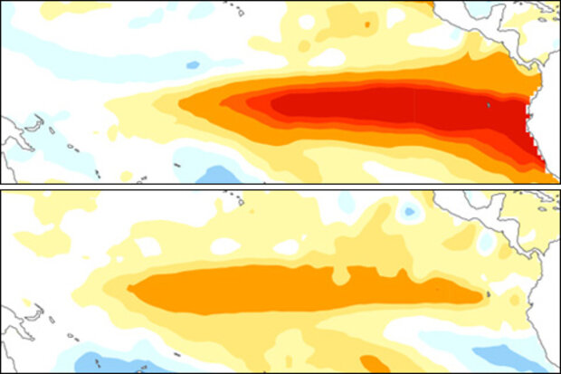
No, we’re not just talking about ice cream in this post (mmm…. yum), but about the different types, or flavors, of the El Niño-Southern Oscillation (ENSO). These different flavors of ENSO are usually based on the location where tropical Pacific sea surface temperature (SST) anomalies are the largest. There is debate on whether differences in the cold state of ENSO, La Niña, can be classified (1), so we’ll leave that alone for now and focus on the warm state, El Niño.
El Niño can take on a wide range of flavors, but here we show two examples of El Niño winters that are at opposite extremes:
(1) Eastern Pacific El Niño (a.k.a. Cold Tongue, Conventional, or Canonical El Niño):
(2) …
Read article
Do we sound like a broken record? The CPC/IRI El Niño-Southern Oscillation forecast released today is essentially unchanged from last month, with around 60-65% chance of El Niño, starting in October-November. Sea surface temperatures in the Niño3.4 region are +0.3°C over the last week, a downwelling Kelvin wave continues to transport warm water toward the eastern equatorial Pacific, and global climate models continue to call for the development of a weak El Niño.
Just how good are these models, though? In our last post, Tony discussed ENSO forecasts over the last few years, including prediction for El Niño in the fall of 2012 that never materialized. Here, I’ll take a look at one forecast…
Read article
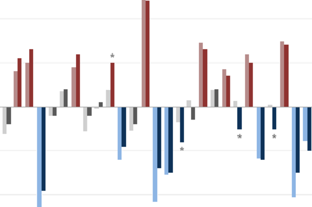
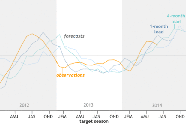
People often want to know how accurate today’s ENSO (El Niño-Southern Oscillation) predictions are. To provide a flavor for how they have been performing lately, we look at results since 2012. For an assessment of ENSO predictions over 2002-2012, check out Barnston et al. (2012).
One of my responsibilities as the lead ENSO forecaster at IRI is to judge how well the forecasts have matched reality. One way I do this is I go back through the archived forecasts and make graphics that compare the forecasts with actual sea surface temperature observations. I look for places where they agree and where they don’t, and try to understand what went wrong where they don’t. But eyeballing …
Read article
