Average temperature maps can wash out days or weeks of hot and cold extremes that are important for things like energy planning and crop risk assessment. Jake Crouch explains how degree-day maps can bring back the details.
A blog by the nation’s official climate record keepers.
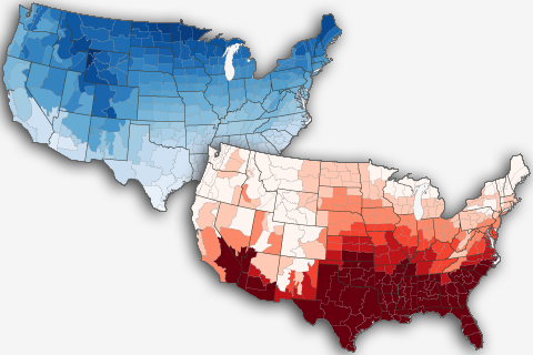
Average temperature maps can wash out days or weeks of hot and cold extremes that are important for things like energy planning and crop risk assessment. Jake Crouch explains how degree-day maps can bring back the details.
A quick spin around the March 2018 U.S. climate scene, all else being equal.
You wouldn't know it to look at the snow falling in the Mid-Atlantic, but according to meteorological convention, winter ended in February. In today’s "Beyond the Data" post, we’ll pull some fun regional trivia out of the national climate summary for February/winter. Bonus: there’s at least one lesson about the climate system in each nugget.
Have you ever wondered what the biggest, hottest, coldest or deepest weather records were for your state? So have many people. These data are interesting on the surface, but going Beyond the Data, they also help us think about resiliency in the face of weather, or climate or climate change, or some combination of the above.
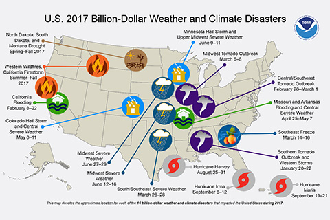
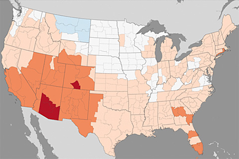
Counting the California wildfires as a single event, the U.S. experienced 16 weather or climate disasters costing at least $1 billion dollars, tying the year with 2011. Total estimated cost was a record-setting $306.2 billion.
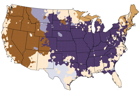
Our climate is changing. To help our users see how different times and places are warming at different rates, NCEI has created a new series of trend maps for the contiguous U.S. In this blog, NCEI's Jake Crouch gives us a show and tell featuring the new maps.
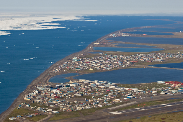
In an ironic exclamation point to swift regional climate change in and near the Arctic, the average temperature observed at the weather station at Utqiaġvik has now changed so rapidly that in November 2017, it triggered an algorithm designed to detect artificial changes in a station’s record and disqualified itself from the NCEI Alaskan temperature analysis.
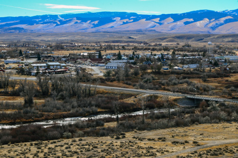
The interim director of NOAA's High Plains Regional Climate Center talks about partnering with tribes on the Wind River Indian Reservation to develop new tools and resources for coping with drought.
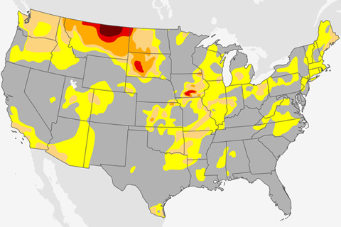
Drought emerged quickly in the Northern Plains this past summer. How does that fit with the bigger picture of what we know about drought and climate?

Record high sea levels and rainfall extremes have buffeted Hawaii and other U.S. Pacific islands this year.