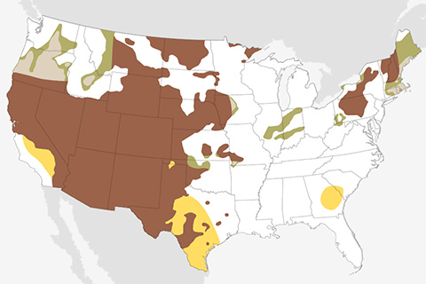
December 2020 and the start of the 2020-2021 winter looks warmer and drier than average for much of the country.
October 2020 was the fourth warmest October on record dating back to 1880, which makes it the lowest-ranked month so far in 2020.
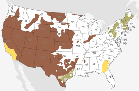
November 2020 is favored to be warmer than average for much of the United States and drier than average across the southern US.
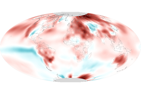
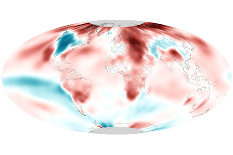
September 2020 was the hottest September on record for the globe, continuing a sweltering year.
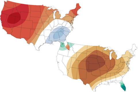
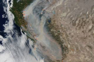
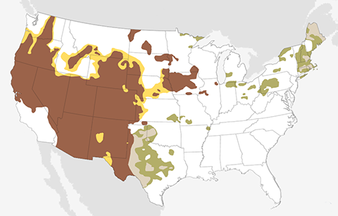
The latest maps from NOAA's Climate Prediction Center show where October 2020 is forecast to be much hotter and drier than average in the U.S. It's not a great outlook for the wildfire-affected West.
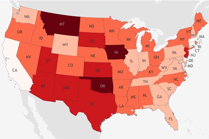
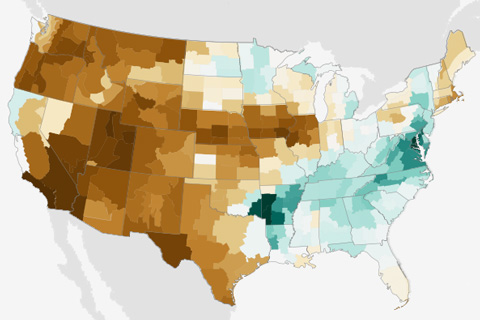
A new NOAA-funded index scores U.S. states' long-term vulnerability to drought, based on a combination of sensitivity, exposure, and their ability to adapt.
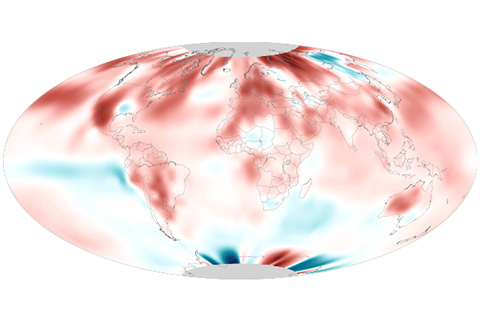
August 2020 was the second-hottest August on record, and it ended the hottest summer on record for the Northern Hemisphere.
Extreme heat in the U.S. Southwest carried August 2020 into the record books as the country’s third-warmest August in the 126-year record. Despite heavy rain from landfalling tropical cyclones, national average precipitation was in the driest third of the record.
The September 2020 temperature and precipitation outlook favors a warmer- and drier-than-average September across the western United States, and a wetter-than-average month across the south-central Plains and much of the East.