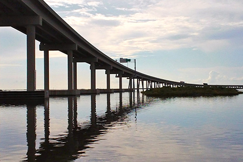
For three days in 2005, flooding from Hurricane Katrina cut off the only road to Port Fourchon. Officials had to decide: did the risk of future flooding justify the cost of raising the roadway out of the Gulf's rising waters?
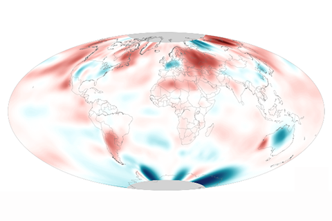
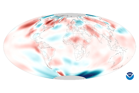
August 2014's globally averaged surface temperature and sea surface temperatures both set new records.
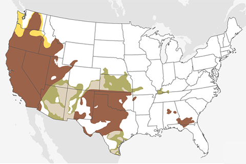
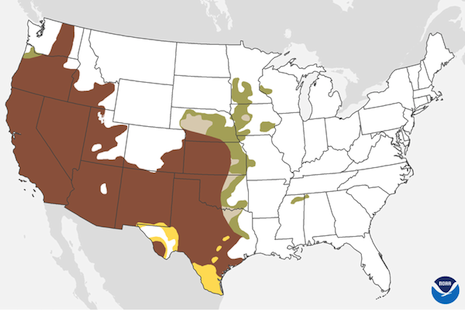
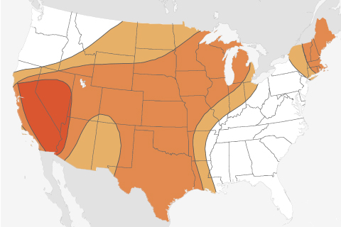
Drought in the far West and the southern portion of the Great Plains—regions that are already experiencing extreme and exceptional drought—will likely continue or worsen through September.
More than halfway through August, the Atlantic Ocean has seen just two named storms. Despite the availability of heat energy at the sea's surface, atmospheric conditions have not been favorable for storm development.
Hot on the heels of a new record set in May, average global temperature also reached a record high in June 2014.
Drought conditions across a large swath of the Western United States are unlikely to improve during May, according to the Monthly Drought Outlook from NOAA's Climate Prediction Center.
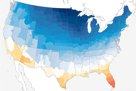
Average temperatures across the contiguous United States in February ranged from frigid to balmy.
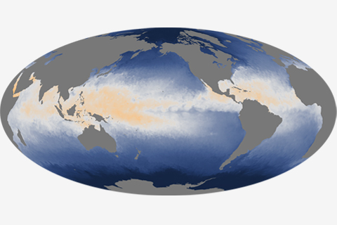
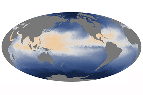
While heat is stored and mixed throughout the depth of the ocean, it is the temperature at the surface—where the ocean is in direct contact with the atmosphere—that plays a significant role in weather and short-term climate.
In July 2013, the Pacific Northwest was relatively dry, while the Southeast got a soaking.