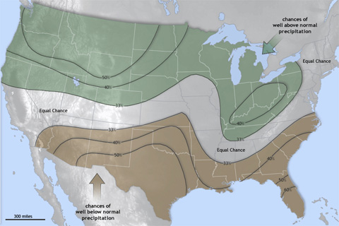
NOAA’s official Winter Outlook for 2011–2012 is unlikely to please many residents of either the still-soggy Missouri River Basin—which experienced historic flooding this past spring and summer—or the parched south-central United States, where severe to exceptional drought has been in place since spring.
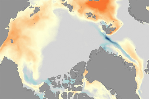
Phytoplankton productivity has increased 20 percent over the past decade as sea ice extent declines and more open water habitat is available.
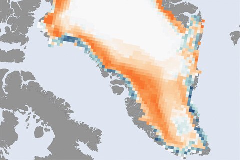
The surface melt season on Greenland lasted up to 30 days longer than average in 2011, and it affected 31 percent of the ice sheet surface. Ice mass loss from Greenland in 2011 was about 430 gigatons—enough ice to raise global sea level by just over 1 millimeter.
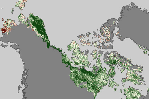
Satellite observations show that as the Arctic tundra has grown warmer in the past three decades, it has also grown “greener.”
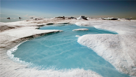
On December 1, NOAA released its annual Arctic Report Card. Like a yearly check-up at the doctor's office, the report summarizes conditions in the Arctic atmosphere, ocean, and on land.

Following a brief interlude of “neutral” sea surface temperature conditions this summer, La Niña has returned to the tropical Pacific Ocean. The cool phase of the El Niño-Southern Oscillation climate pattern is expected to persist through winter.
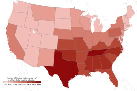
Population and development conspire with regional climate patterns to concentrate the country's most expensive weather disasters in the U.S. South and Southeast.

Maps of locations where heat records were broken in summer 2011 make a nearly complete picture of the United States.

The soaking rains from Tropical Storm Lee provided some drought relief in the South in the first week of September, but exceptional drought persisted across Texas and the Southwest.
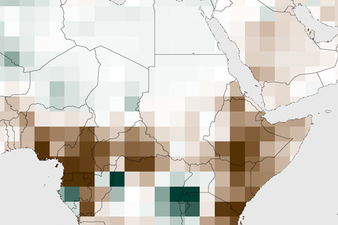
In the semi-arid Horn of Africa, rain comes in two seasons: the “short rains” of October-December and the “long rains” of March-June. In late 2010 and early 2011, both rainy seasons brought scant rain to the region, which led devastating drought across several countries in 2011. In Somalia, the drought escalated to famine.