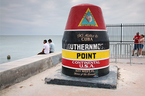
Just a few days ago, on January 26th, 2017, we saw something in the U.S. climate that we hadn’t seen since March 2011.
Just a few days ago, on January 26th, 2017, we saw something in the U.S. climate that we hadn’t seen since March 2011.
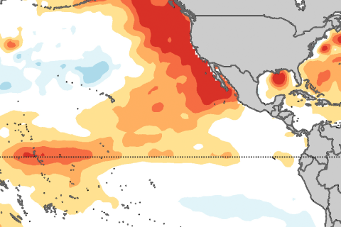
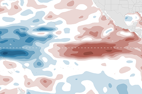
Are sea surface temperatures located north of the equator important for El Niño or La Niña development? Yes! Introducing the Pacific Meridional Mode.
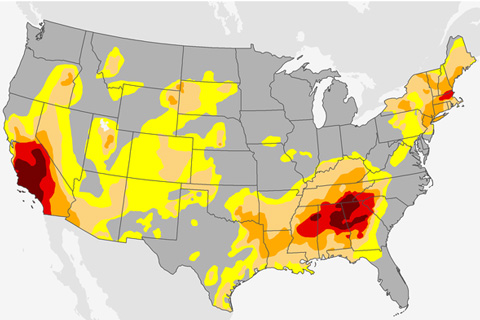
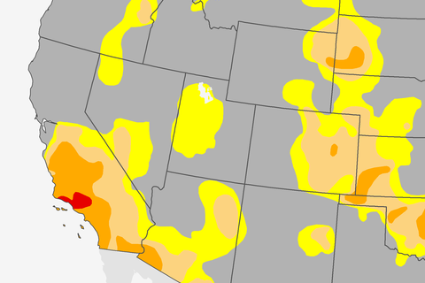
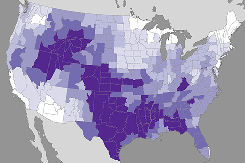
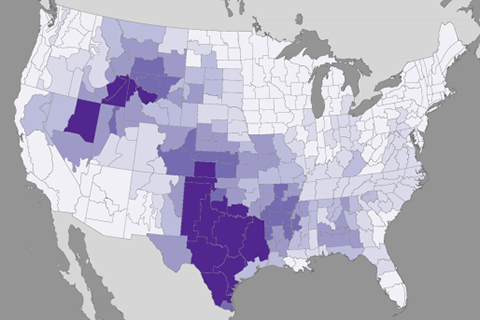
Drought has broken out across the southeast and southern plains this summer and fall. What got us to this situation, and how do we deal drought, which is unlike many of our weather hazards?
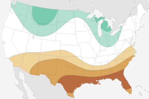
What are NOAA's predictions for this possible La Niña winter of 2016-17, and how did its predictions for last winter fare during the strong El Niño? Guest blogger Mike Halpert gives us the lowdown.
Sometimes, on a long journey, it’s good to revisit the basics. That’s the theme for this edition of Beyond the Data. We’re going old school, looking at some good old climatology adages and truisms, through the lens of a sturdy, reliable warhorse of a dataset.
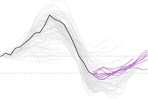
Because why go to the movies when you come to Climate.gov and watch the evolution of ENSO forecasts over the past two years?
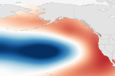
Understanding the Pacific Decadal Oscillation (PDO) as multiple layers of ice cream. And how is it related to the El Niño-Southern Oscillation?
Crack out the popcorn, sit back, and marvel over the decay of El Niño.
For much of the country, summer temperatures are somewhat sensitive to late-spring precipitation. It turns out that summer afternoons are way, way more sensitive than summer nights.
This week's Beyond the Data blog examines how spring precipitation influences summer temperatures, and why this matters a little more in land-locked areas. Flyover Country, from one of your native sons, this blog’s for you.